EN
DE

Welcome to the cutting-edge of uphill cycling
and world's most famous ascents of each of the continents


Welcome to the cutting-edge of uphill cycling
and world's most famous ascents of each of the continents
| Andalusia | |||
 | Mulhacen | 3,482m | |
| | Pico del Veleta | 3,394m | |
| | Pico del Veleta | 3,394m | |
| | O Sel Ling | 1,462m | |
 | Gibraltar Rock | 426m | |
| Canary Islands & Madeira | |||
| | Roque Muchachos | 2,426m | |
| | Tabonal Negro (Teide) | 2,362m | |
| | Pico de las Nieves | 1,945m | |
 | Pico do Arieiro | 1,802m | |
| | C. Pedro Gonzales | 490m | |
| Pyrenees | |||
 | Port d'Envalira | 2,408m | |
| | Ordino Arcalis | 2,232m | |
 | Col du Tourmalet | 2,115m | |
| | Col d'Aubisque | 1,709m | |
| | Col de Peyresourde | 1,569m | |
| | Col d'Aspin | 1,489m | |
| | Col du Soulor | 1,450m | |
| Mallorca | |||
| | Puig Major | 1,433m | |
| | Sa Calobra | 718m | |
| | Coll d'Honor | 550m | |
| | San Salvador | 510m | |
| | Coll de Sóller | 497m | |
| | Port de Valdemossa | 323m | |
| | Cap de Formentor | 225m | |
| Giant Mountains & Ore Mountains | |||
 | Sniezka | 1,602m | |
 | Modré Sedlo | 1,500m | |
| | Vrbatova Bouda | 1,400m | |
 | Klinovec | 1,244m | |
 | Fichtelberg | 1,215m | |
| | Spindlerpass | 1,200m | |
| Balkans | |||
 | Štulac Sedlo | 1,957m | |
| | Durmitor Sedlo | 1,908m | |
 | Kopaonik | 1,805m | |
 | Sveti Jure | 1,762m | |
 | Qafa Thores | 1,681m | |
 | Visočica Sedlo | 1,625m | |
 | Galičica Sattel | 1,564m | |
 | Prevalac | 1,560m | |
| | Qafa Bordolecit | 1,355m | |
| | Krstac | 958m | |
| Scandinavia | |||
 | Juvasshytta | 1,851m | |
| | Dalsnibba | 1,459m | |
 | Flatruet | 975m | |
| | Trollstigen | 866m | |
| | Ørnevegen | 623m | |
 | Muotkatakka | 565m | |
 | Halfdan | 504m | |
| | Kleifaheidi | 413m | |
 | Møllehøj | 171m | |
| Baltics | |||
 | Suur Munamägi | 318m | |
 | Gaizinkalns | 312m | |
 | Aukštojas | 294m | |
| Benelux | |||
 | Botrange | 694m | |
 | Kneiff | 560m | |
 | Vaalserberg | 323m | |
| Great Britain & Ireland | |||
 | Great Dun Fell | 848m | |
 | Mount Leinster | 793m | |
 | Lowther Hill | 724m | |
| | Cairnwell Pass | 670m | |
 | Bwlch y Groes | 550m | |
| | Bwlch Pen-y-Feidiog | 530m | |
| | Sally Gap | 501m | |
 | Spelga Dam | 404m | |
| European micro states | |||
| | Port d'Envalira | 2,408m | |
 | Pfälzerhütte | 2.108m | |
 | Monte Titano | 652m | |
 | Dingli Cliffs | 245m | |
 | Chemin Révoires | 164m | |
 | Vatican Hill | 77m | |
| Carpathians | |||
 | Transalpina | 2,145m | |
| | Transfagarasan | 2,042m | |
 | Sliezsky Dom | 1,670m | |
| Cornesti Hills (Moldova) | |||
 | Balanesti Hill | 429m | |
| Voras Mountains (Greece) | |||
 | Voras Ski Center | 2.074m | |
| Yildiz Mountains (Turkey) | |||
 | Mahya Dagi | 1,031m | |
| Serra da Estrela (Portugal) | |||
 | Pico Torre | 1,993m | |
| Trodoos Mountains (Cyprus) | |||
 | Olympos | 1,950m | |
| Matra Mountains (Hungary) | |||
 | Kekestetö | 1,014m | |
| Rila Mountains (Bulgaria) | |||
 | Kalin reservoir | 2,550m | |
| Germany | |||
| | Osterfelderkopf | 2,032m | |
| | Nebelhorn | 1,932m | |
| | Alpe Schlappold | 1,740m | |
| | Eagle's Nest | 1,716m | |
| | Roßfeld-Höhenring | 1,540m | |
| | Riedbergpass | 1,420m | |
| | Feldberg | 1,493m | |
| | Fichtelberg | 1,215m | |
| | Brocken | 1,142m | |
| | Salwert | 11m | |
| Great Caucasus (Georgia) | |||
 | Abano Pass | 2,865m | |
| | Gergeti Trinity | 2,170m | |
| Andes | |||
 | Uturuncu | 5,768m | |
| | Chacaltaya | 5,300m | |
| | Salar de Uyuni | 3,650m | |
| | Yungas Death Road | 3,200m | |
| Himalayas | |||
 | Khardung La | 5,602m | |
| | Taglang La | 5,358m | |
| | Potokonkga La | 4,900m | |
| | Namshang La | 4,800m | |
| | Lamayuru Monastery | 3,714m | |
| Rocky Mountains | |||
 | Mount Evans | 4,307m | |
| Sierra del Escambray (Cuba) | |||
 | Topes de Collantes | 755m | |
| Hawaii | |||
| | Mauna Kea | 4,200m | |
| Ethiopian Highlands | |||
 | Tulluu Dimtuu | 4,377m | |
| Alborz-Range (Iran) | |||
 | Dizinpass | 3,257m | |
| | Emamzadeh Davod | 2,929m | |
| Marathon (European Alps) | |||
 | Ötztal Cycle Marathon | 5,209Hm | |
| | La Marmotte | 5,180Hm | |
 | Maratona Dolomites | 4,190Hm | |
| | Dreiländergiro | 3,546Hm | |
 | Alpenbrevet | 3,643Hm | |
| | Alpen-Challenge | 2,499Hm | |
Very high, extremely challenging, most spectacular - this is the unpaved climb in Italian Aosta Valley up to the mountain station of the Bontadini lift at Theodulpass. Its slope is used by private motorised traffic and thus forms the highest mountain road in the Alps - rideable for mountain bikers only in best weather conditions in midsummer. Boldest bikers even use Theodulpass as the highest accessible transalp variant crossing Plateau Rosa and Theodul glacier down to Zermatt in Switzerland.
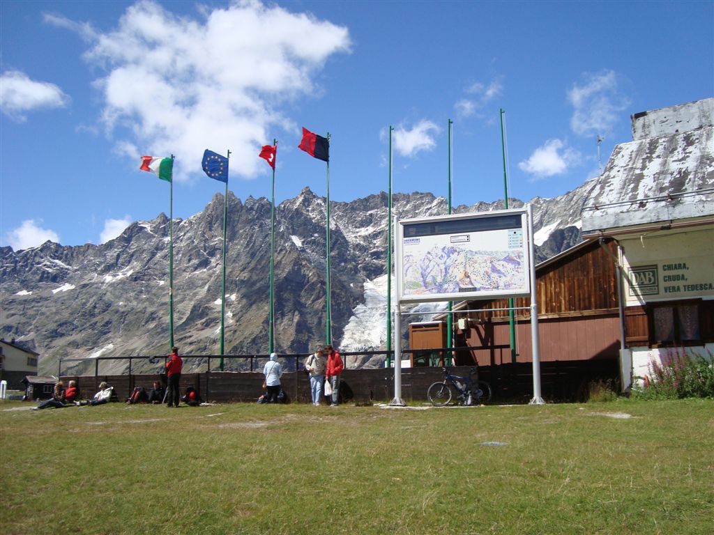
Start: Breuil Cervinia 2,003m
Altitude difference: 1,330m
Distance: 12km
August 2019
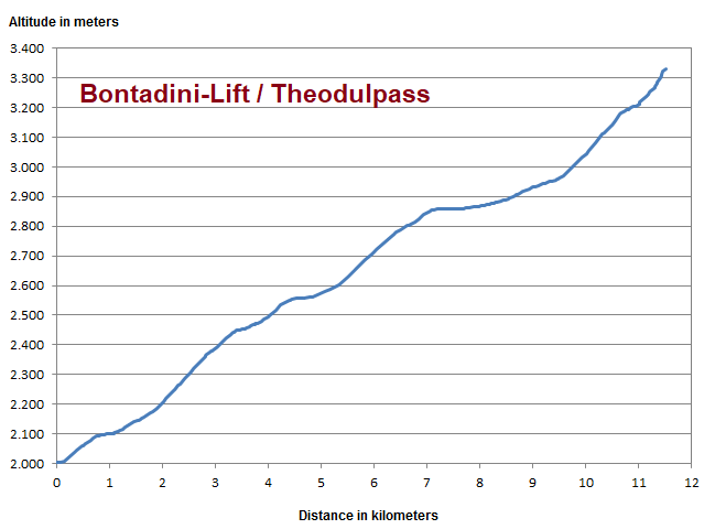
Adjusted for the few flat passages the brutal profile reveals an average slope of approx. 15% heading at its end with more than 20% grade to pass summit. Several pushing passages are unavoidable.
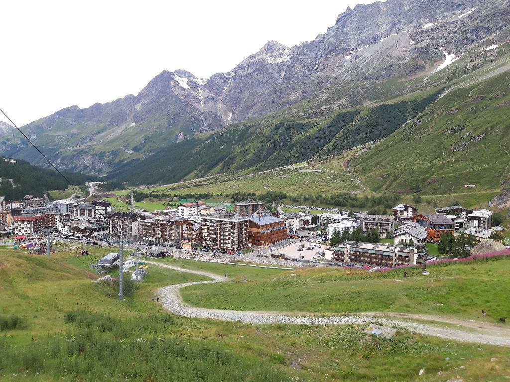
Eight years after the first attempt (see below) we start again in the Italian ski resort Breuil Cervinia.
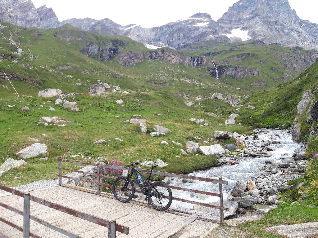
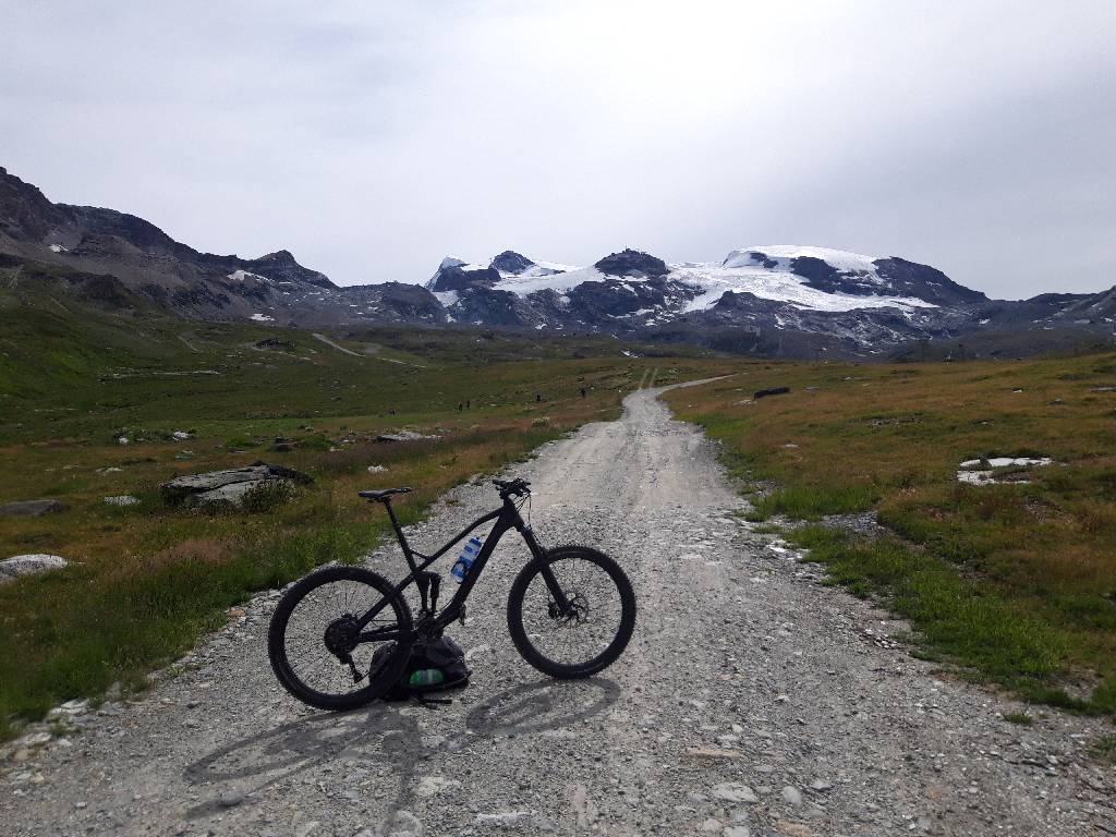
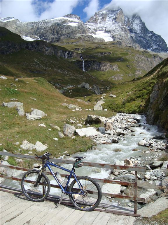
Again at this brook crossing - but this time with much less wind and a more pleasant 24/40 gear, however still without engine assistance - being quite exotic nowadays among mountain bikers in this area.
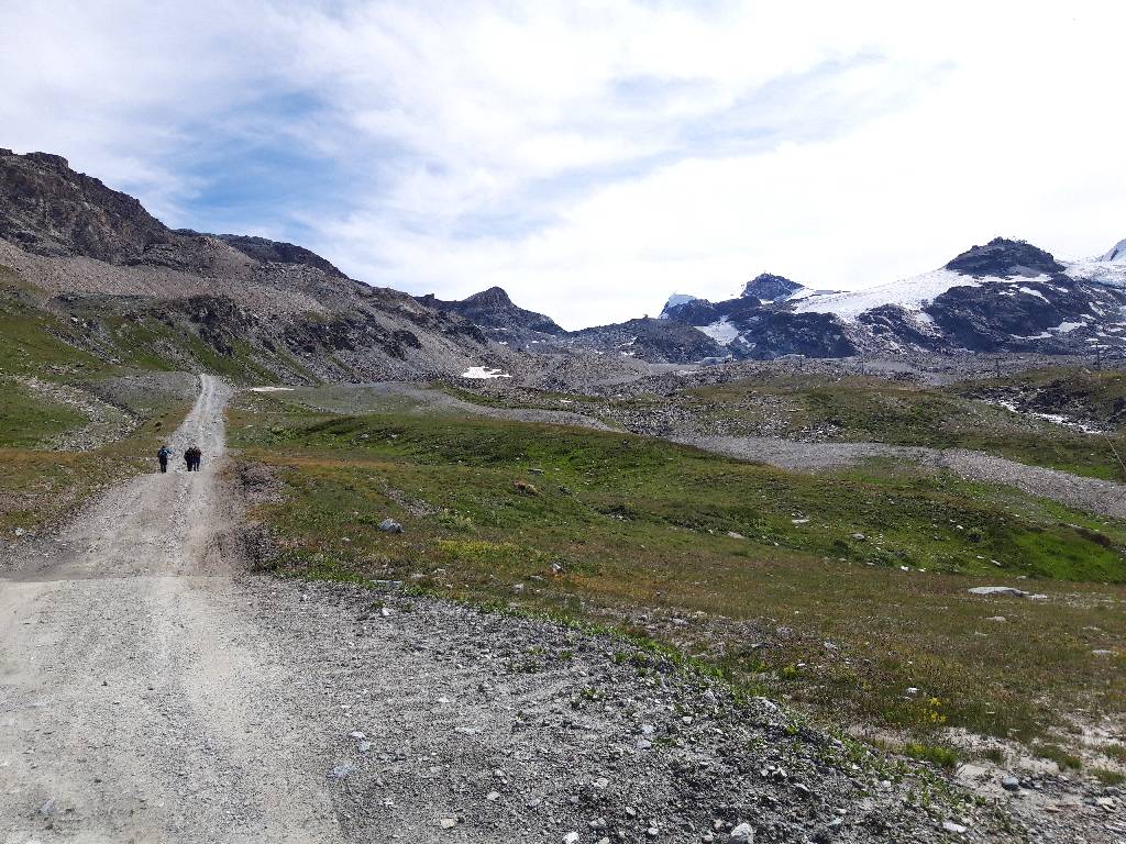
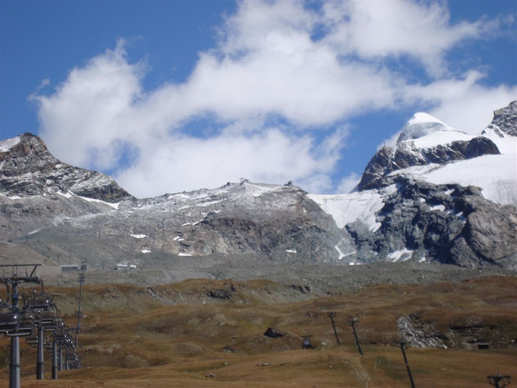
First few kilometers already require power and technical skills in the smallest gear. In the haze of the early morning this flat passage on the way to Plan Maison station provides the first view of today's destination. From left: Furgsattel, Bontadini station, Theodul hut, Little Matterhorn, Testa Grigia, Breithorn massif
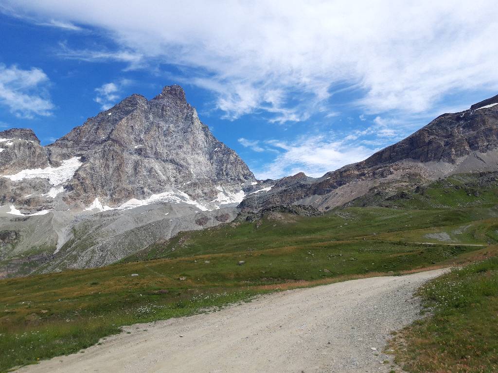
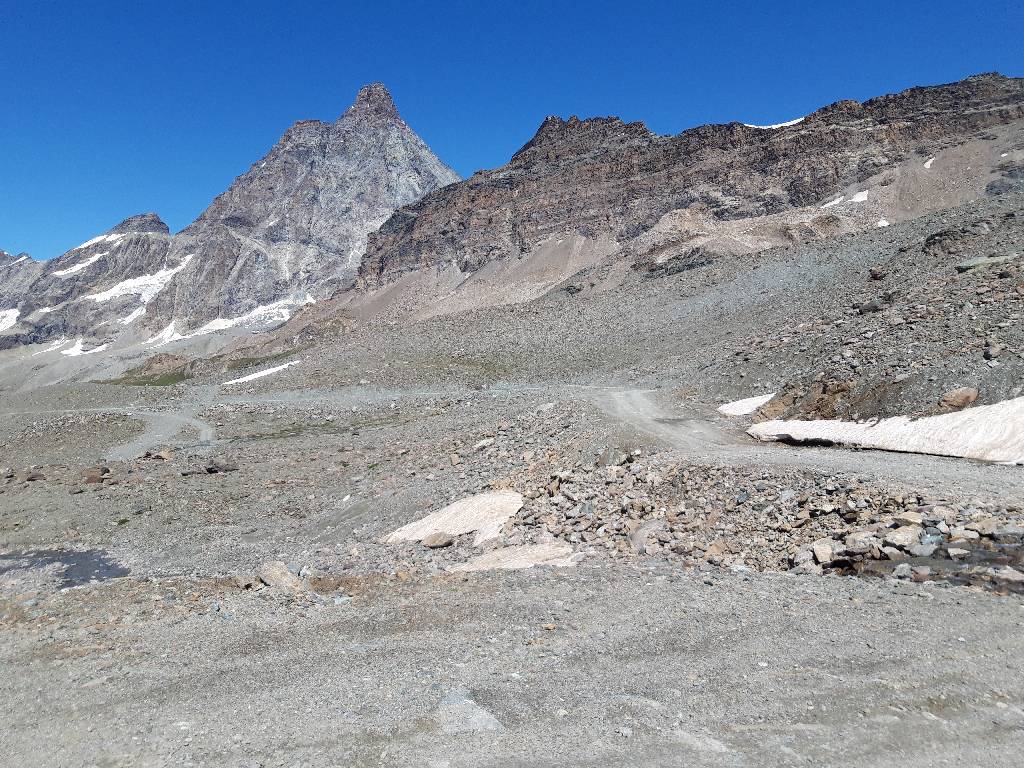
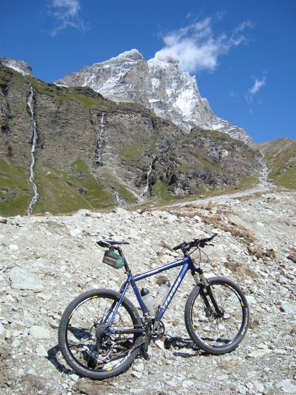
The sky clears up slowly and constant view of imposing back of Matterhorn mountain accompanies the ride.
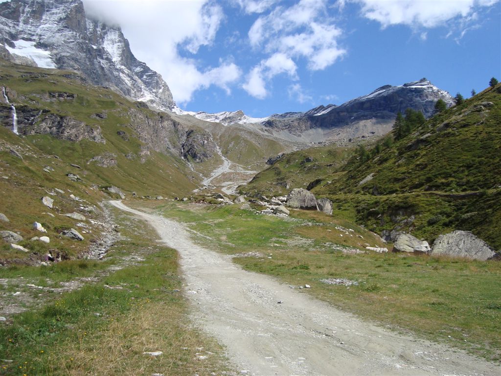
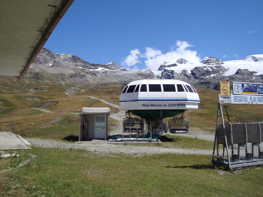
Behind valley station of cable car station Plan Maison the way leads straight ahead up the road.
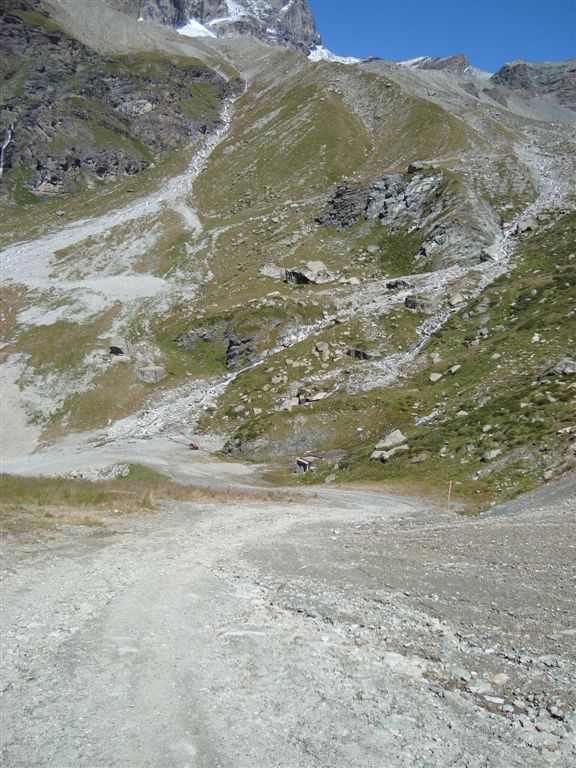
Look back at the same spot
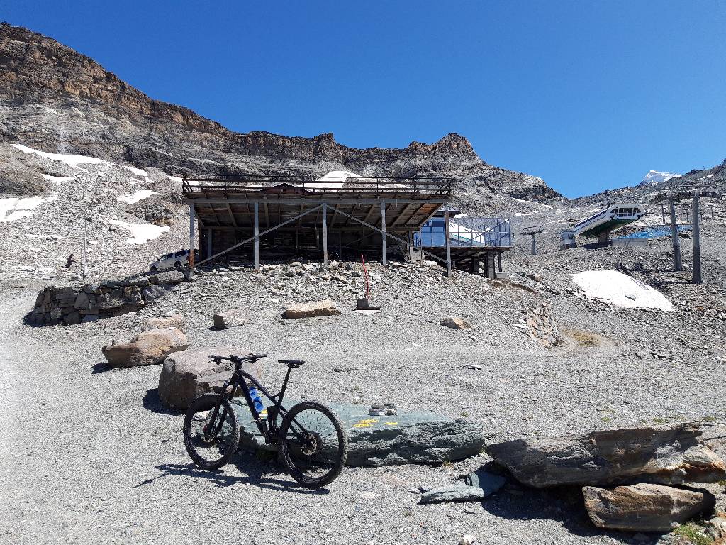
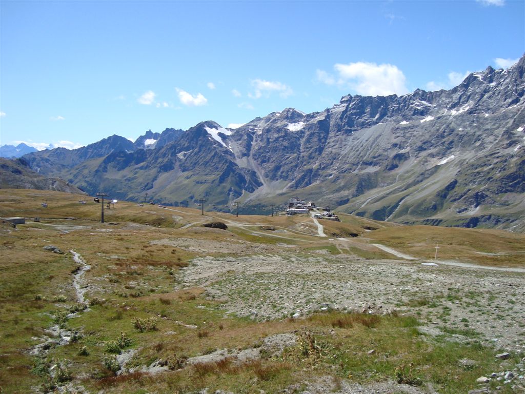
At the end of the long straight way you get to Plan Maison mountain station and Fornet valley station. Hikers choose the direttissima way on the left, which is far too steep for the bike. Instead we turn right to the two cable car stations.
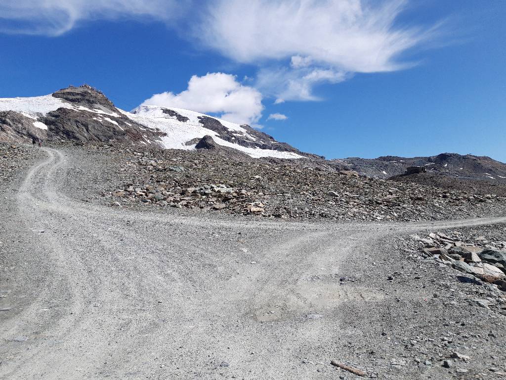
Right behind the Fornet valley station the way actually turns left side with a 17% grade. But I choose the path to the right, which leads upwards in a significantly wider arc and is thus supposedly less steep.
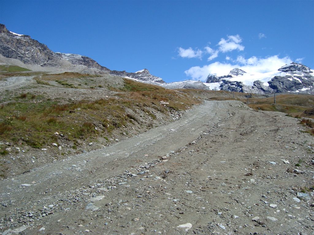
The path is indeed much more moderate than the direct ascent, but is unfortunately washed out by meltwater and increasingly blocked and expired. The road is no longer used by motor vehicles and therefore proves to be the wrong choice.
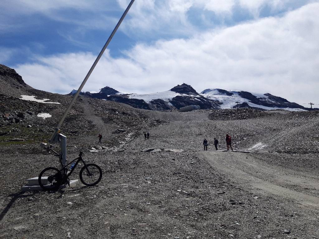
After a good deal of pushing you get back to the main path and the Bontadini valley station in just over 3,000m.
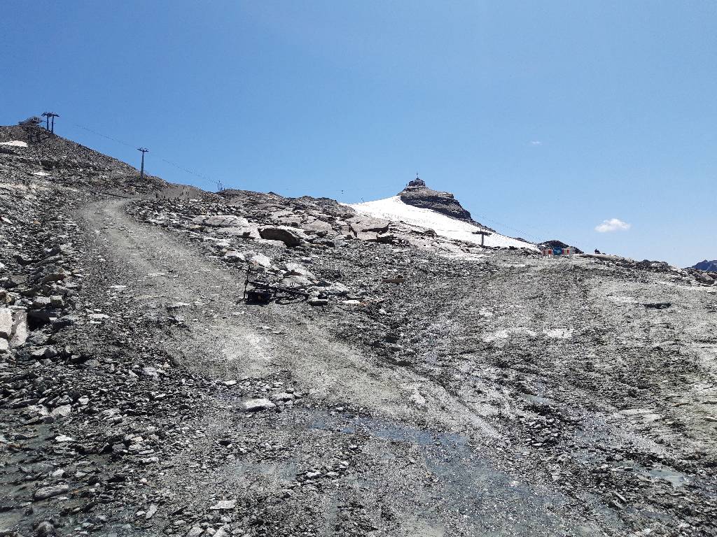
Behind it becomes even more demanding and riding the bike is almost impossible here. At this point there is a branch off to the right leading in a wider serpentine arch to the pass summit.
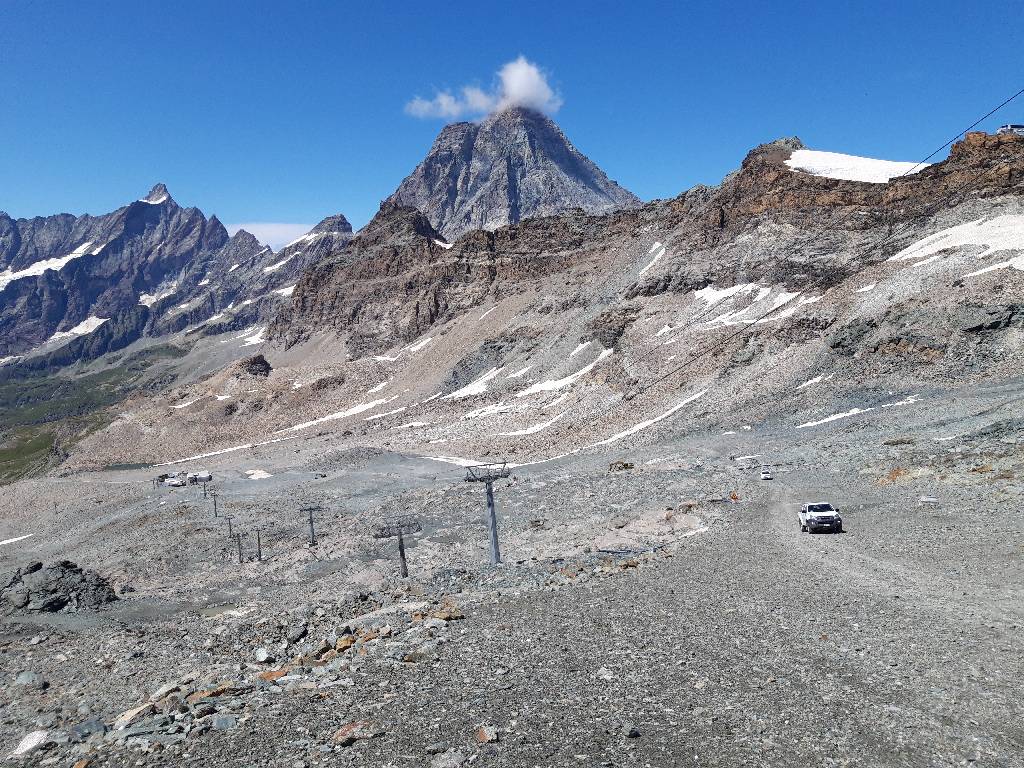
Back on the main path this is the view to Matterhorn mountain. Note the motorised vehicles traveling here at 3,200 meters altitude.
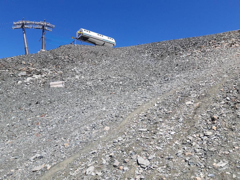
Within reach: the object of desire
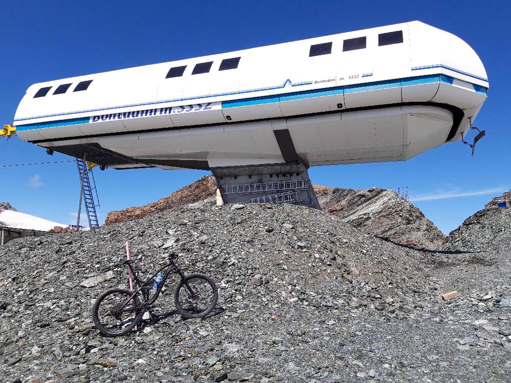
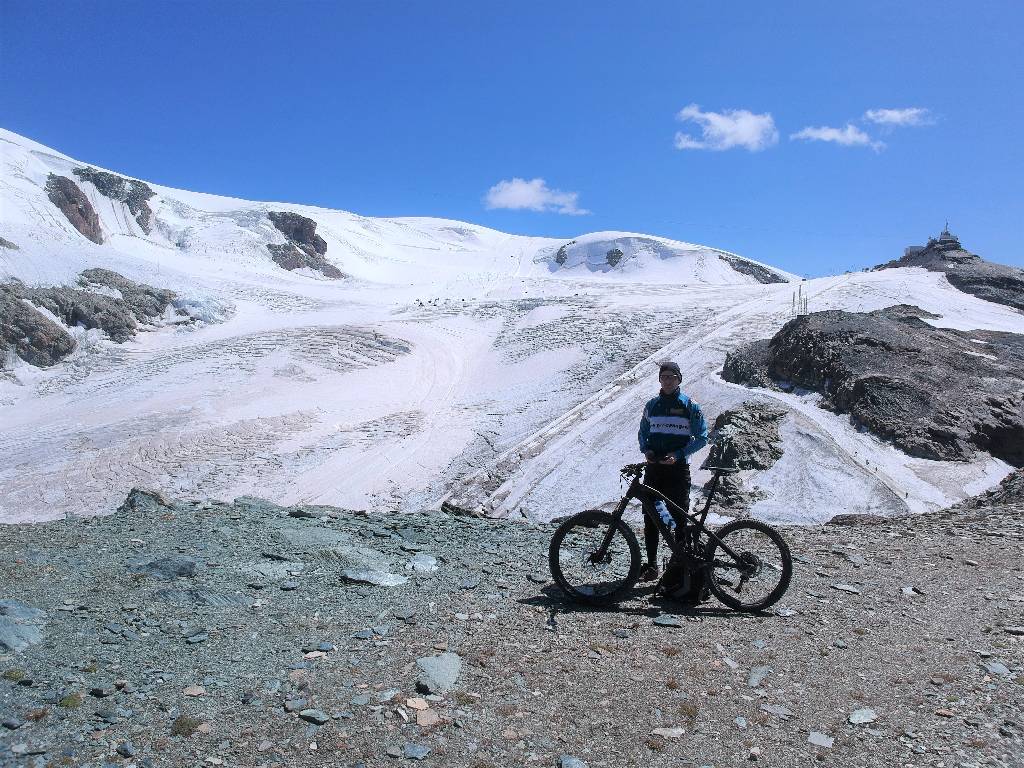
And finally, after hours of exhausting ride (and a lot of pushing), you stand in 3,332m altitude at the top station of the Bontadini lift.
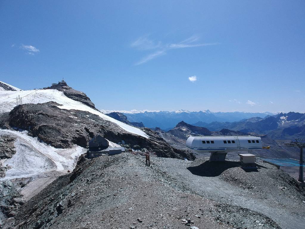
At the very back the Testa Grigia with ist transmission mast (and this magnificent webcam), in front of it in the middle of the image the Rifugio Teodulo and in front right the Bontadini mountain station
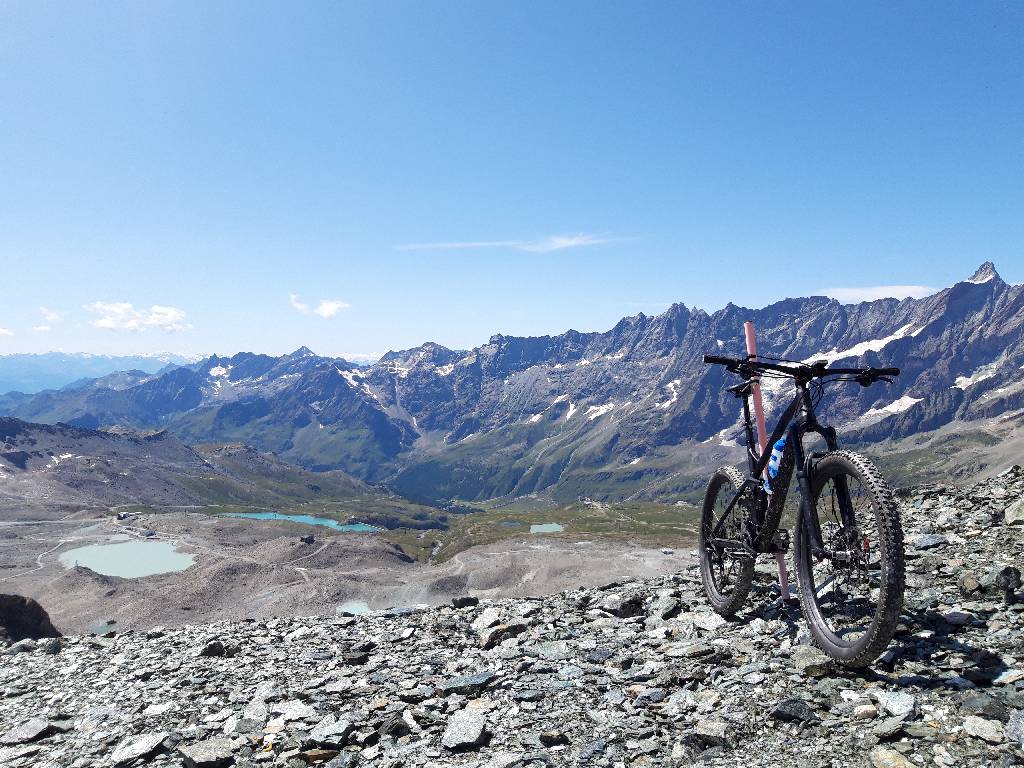
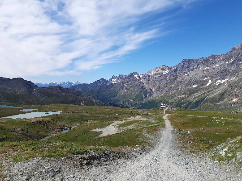
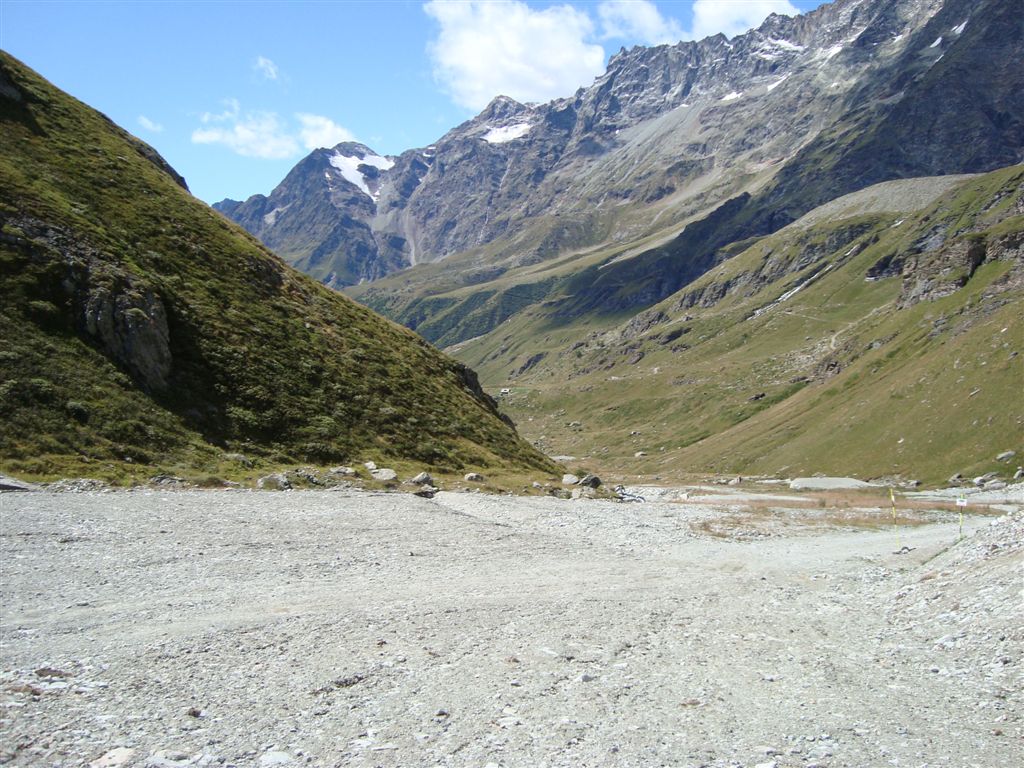
Spectacular view from the top of the pass down to the ascent from the west
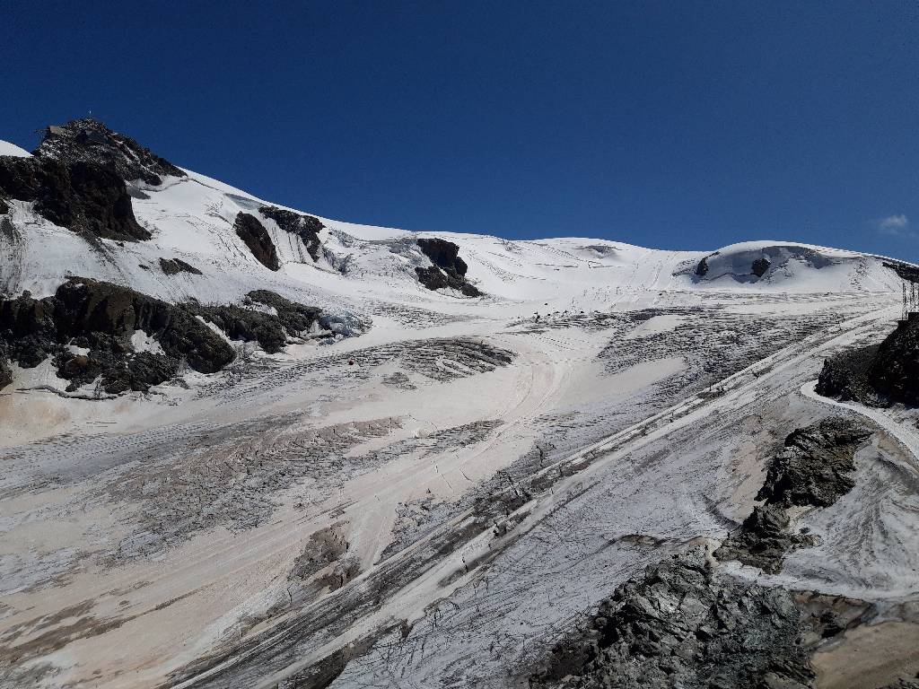
And then the breathtaking view to the east with the Plateau Rosa glacier field
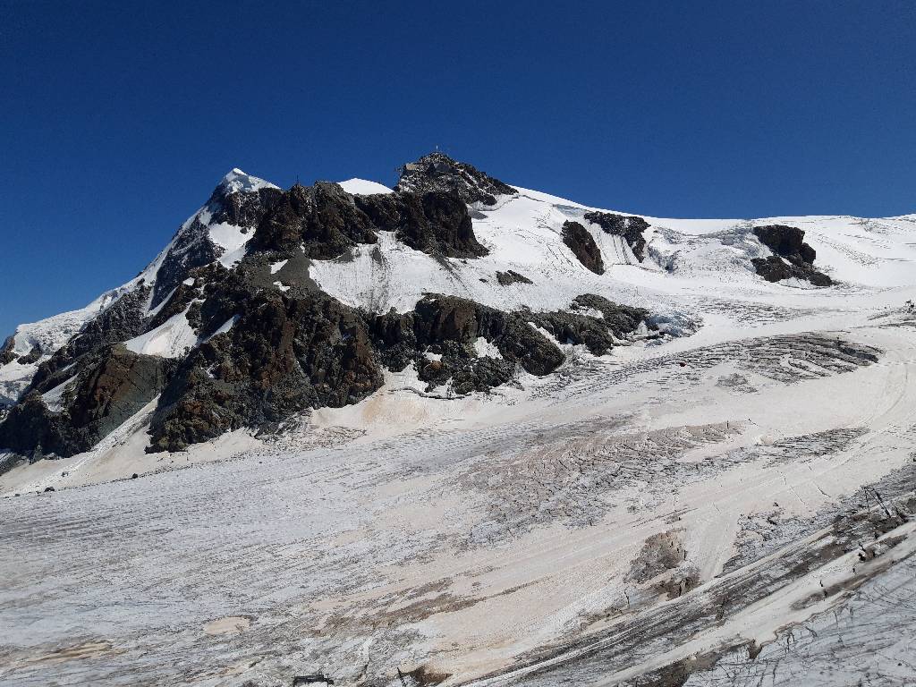
Opposite the Little Matterhorn with the highest cable car in Europe. The huge Theodul glacier underneath is used by skiers in the summer and even mountain (fat)bikers are said to have been here too.
Highest accessible spot in the Alps :-)
----------------------------
The following description in the original from the year 2011:
Bontadini-Lift 3,332m
(not summitted)
Italian Bontadini-Lift situated at the south side of Mt. Cervinio (= "Matterhorn") has been named on several respective websites as the highest motorable runway in the Alps and all-terrain vehicles obviously reached the mountain station of that ski-lift in the past. However, the runway has been closed for public motorized traffic since 2009, but as a cyclist you still may reach the top. Valley station of that ski-lift is located some 3,000 meters above sea level and the top station is built at an elevation of 3,332 meters close to Theodulpass at the border to Switzerland. Only a very narrow time-frame in the summer (end of August) may allow an inspection of the snow-free runway. Equipped with GPS and a barometric altimeter, with satellite images and a detailed Italian map of the area I tried to reach the top on a mountain bike - but failed! The slope is very steep, consists of loose stones and becomes even steeper and rocky in the upper part. For an ordinary trained cyclist this runway is impassable. (Anyhow, as compensation for the Bontadini failure a climb up Great St Bernard followed the next day - one of the most spectacular mountain passes in Europe!)
Start: Breuil Cervinia 2,020m
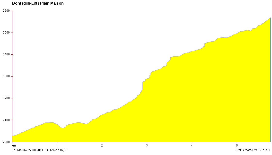
Bumpy profile image shows steep ramps. Measured peak value was 30% on the first five kilometers. This profile ends some 1,000 meters behind the ski-station Plan Maison.
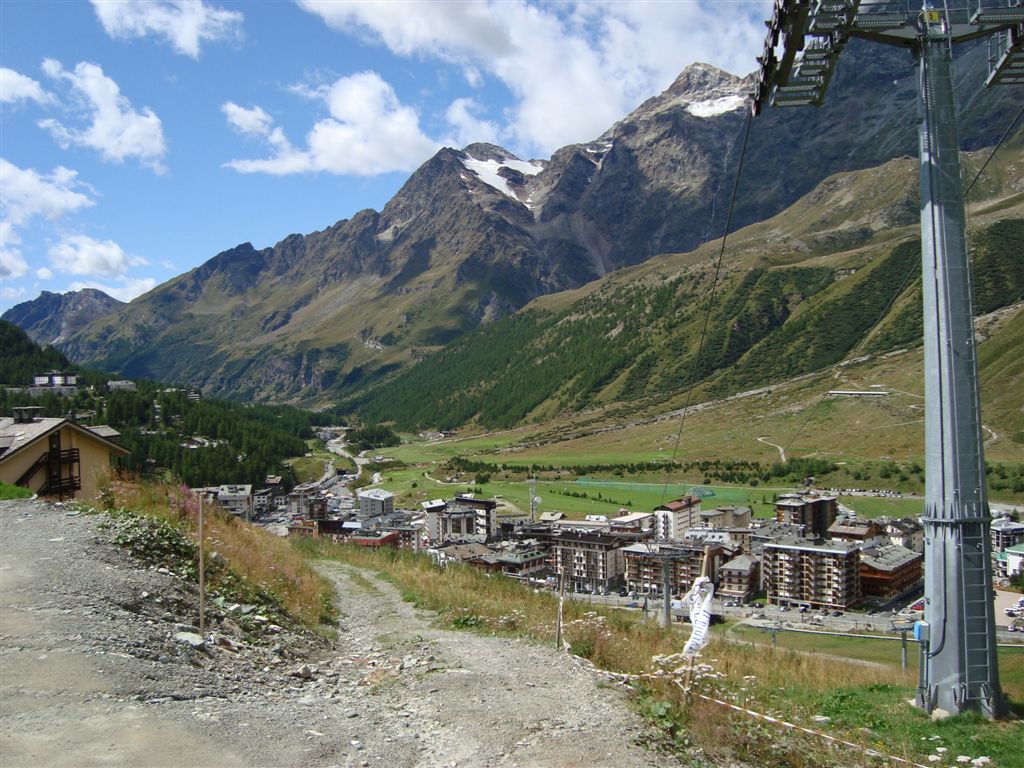
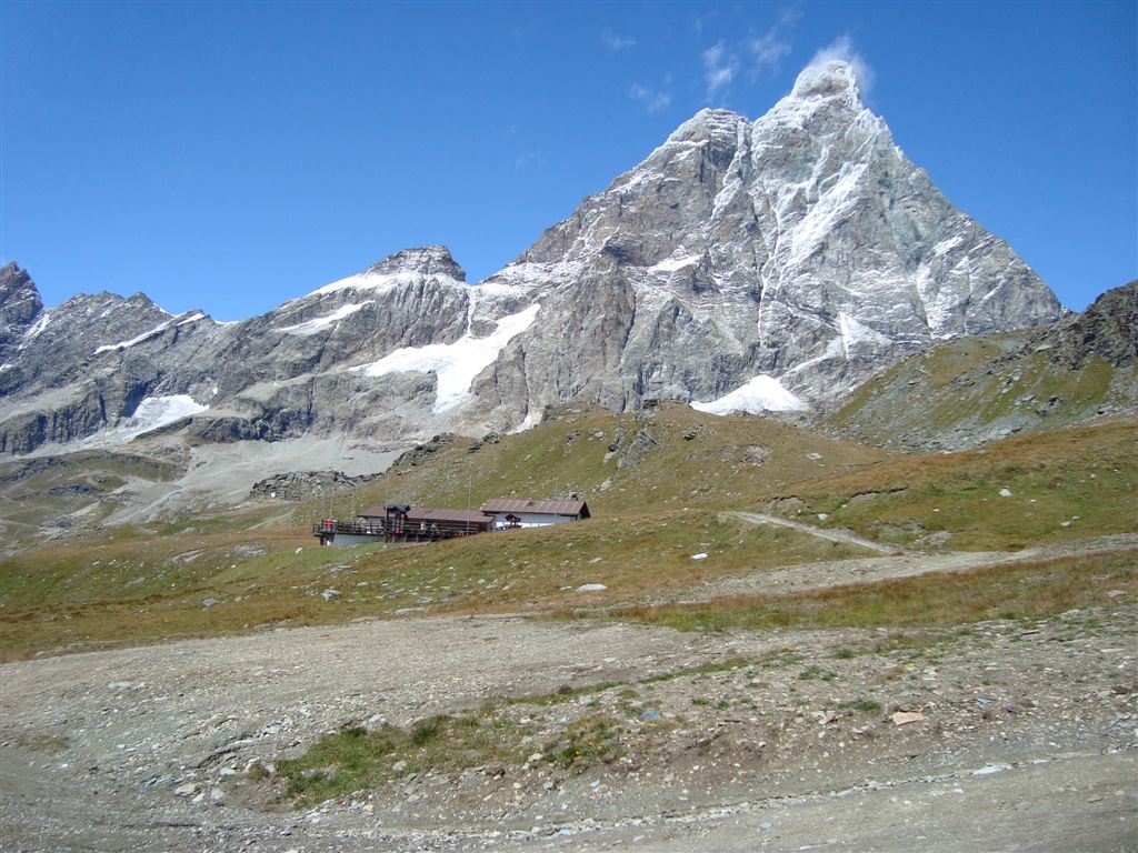
Start is in the village of Breuil Cervinia at an altitude of some 2,000 meters. The spot is located at the end of a side valley reachable from the Italian Aosta-valley. The village is surrounded by several 3,000m peaks at the foot of 4,478m high Matterhorn. A cabin lift is operated even in summer and carries hikers to the ski area of Plan Maison at an elevation of 2,500 meters.
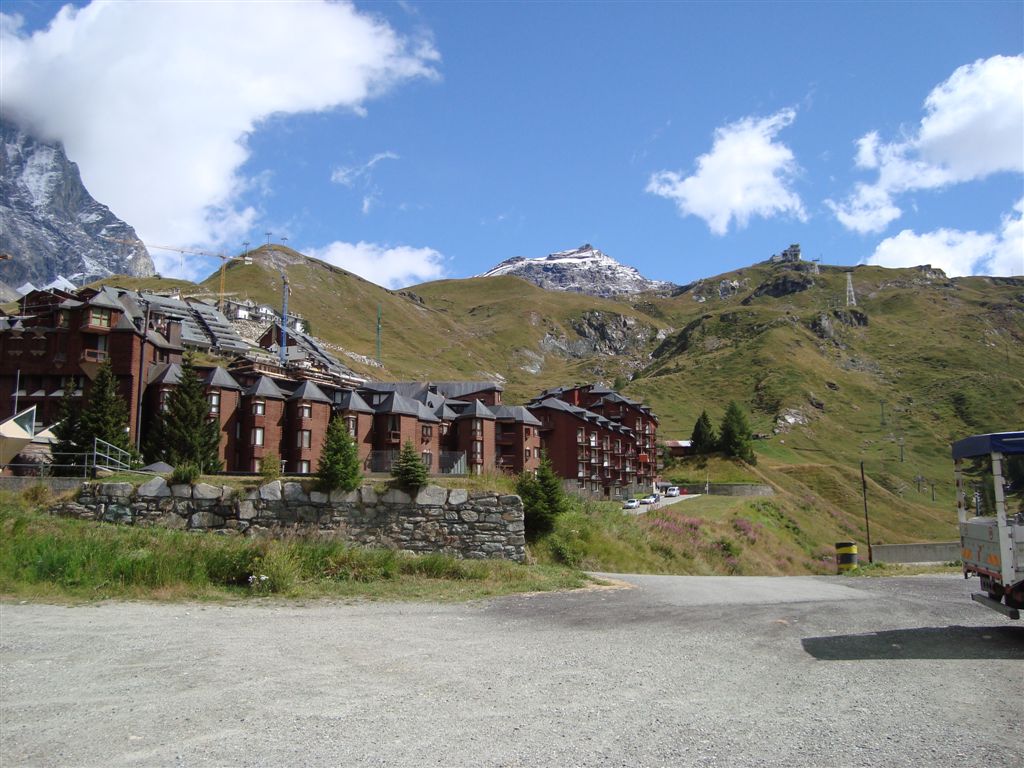
On the top right the ski station Plan Maison is visible. Behind that station are some more 800 meters of height gain up to Theodulpass.
At first it is hard to orientate oneself and to find the correct way between several lift masts. Left of this little beck the longest way winds up to Plan Maison. Thus it should be in theory the way with the lowest grade.
This is the view of the way up - looks easily to ride. Unfortunately, a photograph can never provide further relevant information: The actual incline and the wind regime. Despite the good weather conditions a strong wind blows through this basin.
After only 2,800 meters of distance the way is no longer cycable. The bike computer reports an incline of more than 20% and the front wheel slips off the track. If you do not have the necessary strength and technical experience you can already terminate your riding trip right here.
Cold comfort: The scenery is amazing next to 2,000 meters high south wall of Matterhorn.
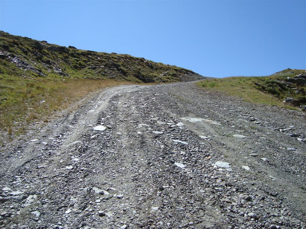
The next passage of pushing the bike follows. The slope is that steep that it is not possible to get back into the saddle. Even oncoming Downhill-Freaks slow down their bikes on this ram...
Same ramp from above - free fall! Just to illustrate the proportions: The red spot left of the image center is an All-terrain-Quad with four wheels...
Plan Maison is attained, but half of the way was rather walking than cycling. Indeed, the way to Bontadini-Lift can not be named rideable. Anyhow, I want to have a look at Bontadini-Lift at least.
At the very top in the center of the image you can identify the upper station of the lift and even Theodul-Hut at an elevation of 3,300 meters.
This picture gives an idea of the wind regime and the coldness up here.
As I still do not want to give up my ride at this point I proceed my way through the lift masts. After further 800 meters of distance I have managed an altitude gain of 100 meters � formidable grade! The total grade of 12% since the start in Breuil Cervinia consists of alternating moderate parts (i.e. 7-8%) and very steep ramps of more than 20%.
Although the way does not look that severe: At an altitude of 2,600 meters I am pissed off that runway. Wind squalls push me out of the saddle and a next part of walking would compulsory follow. End of the ride!
As a conclusion Bontadini-Lift will be removed from the summary of the highest cycable mountain roads in the Alps. But there is an awesome view of Mt. Matterhorn!


