EN
DE


Welcome to the cutting-edge of uphill cycling
and world's most famous ascents of each of the continents


Welcome to the cutting-edge of uphill cycling
and world's most famous ascents of each of the continents
| Andalusia | |||
 | Mulhacen | 3,482m | |
| | Pico del Veleta | 3,394m | |
| | Pico del Veleta | 3,394m | |
| | O Sel Ling | 1,462m | |
 | Gibraltar Rock | 426m | |
| Canary Islands & Madeira | |||
| | Roque Muchachos | 2,426m | |
| | Tabonal Negro (Teide) | 2,362m | |
| | Pico de las Nieves | 1,945m | |
 | Pico do Arieiro | 1,802m | |
| | C. Pedro Gonzales | 490m | |
| Pyrenees | |||
 | Port d'Envalira | 2,408m | |
| | Ordino Arcalis | 2,232m | |
 | Col du Tourmalet | 2,115m | |
| | Col d'Aubisque | 1,709m | |
| | Col de Peyresourde | 1,569m | |
| | Col d'Aspin | 1,489m | |
| | Col du Soulor | 1,450m | |
| Mallorca | |||
| | Puig Major | 1,433m | |
| | Sa Calobra | 718m | |
| | Coll d'Honor | 550m | |
| | San Salvador | 510m | |
| | Coll de Sóller | 497m | |
| | Port de Valdemossa | 323m | |
| | Cap de Formentor | 225m | |
| Giant Mountains & Ore Mountains | |||
 | Sniezka | 1,602m | |
 | Modré Sedlo | 1,500m | |
| | Vrbatova Bouda | 1,400m | |
 | Klinovec | 1,244m | |
 | Fichtelberg | 1,215m | |
| | Spindlerpass | 1,200m | |
| Balkans | |||
 | Štulac Sedlo | 1,957m | |
| | Durmitor Sedlo | 1,908m | |
 | Kopaonik | 1,805m | |
 | Sveti Jure | 1,762m | |
 | Qafa Thores | 1,681m | |
 | Visočica Sedlo | 1,625m | |
 | Galičica Sattel | 1,564m | |
 | Prevalac | 1,560m | |
| | Qafa Bordolecit | 1,355m | |
| | Krstac | 958m | |
| Scandinavia | |||
 | Juvasshytta | 1,851m | |
| | Dalsnibba | 1,459m | |
 | Flatruet | 975m | |
| | Trollstigen | 866m | |
| | Ørnevegen | 623m | |
 | Muotkatakka | 565m | |
 | Halfdan | 504m | |
| | Kleifaheidi | 413m | |
 | Møllehøj | 171m | |
| Baltics | |||
 | Suur Munamägi | 318m | |
 | Gaizinkalns | 312m | |
 | Aukštojas | 294m | |
| Benelux | |||
 | Botrange | 694m | |
 | Kneiff | 560m | |
 | Vaalserberg | 323m | |
| Great Britain & Ireland | |||
 | Great Dun Fell | 848m | |
 | Mount Leinster | 793m | |
 | Lowther Hill | 724m | |
| | Cairnwell Pass | 670m | |
 | Bwlch y Groes | 550m | |
| | Bwlch Pen-y-Feidiog | 530m | |
| | Sally Gap | 501m | |
 | Spelga Dam | 404m | |
| European micro states | |||
| | Port d'Envalira | 2,408m | |
 | Pfälzerhütte | 2.108m | |
 | Monte Titano | 652m | |
 | Dingli Cliffs | 245m | |
 | Chemin Révoires | 164m | |
 | Vatican Hill | 77m | |
| Carpathians | |||
 | Transalpina | 2,145m | |
| | Transfagarasan | 2,042m | |
 | Sliezsky Dom | 1,670m | |
| Cornesti Hills (Moldova) | |||
 | Balanesti Hill | 429m | |
| Voras Mountains (Greece) | |||
 | Voras Ski Center | 2.074m | |
| Yildiz Mountains (Turkey) | |||
 | Mahya Dagi | 1,031m | |
| Serra da Estrela (Portugal) | |||
 | Pico Torre | 1,993m | |
| Trodoos Mountains (Cyprus) | |||
 | Olympos | 1,950m | |
| Matra Mountains (Hungary) | |||
 | Kekestetö | 1,014m | |
| Rila Mountains (Bulgaria) | |||
 | Kalin reservoir | 2,550m | |
| Germany | |||
| | Osterfelderkopf | 2,032m | |
| | Nebelhorn | 1,932m | |
| | Alpe Schlappold | 1,740m | |
| | Eagle's Nest | 1,716m | |
| | Roßfeld-Höhenring | 1,540m | |
| | Riedbergpass | 1,420m | |
| | Feldberg | 1,493m | |
| | Fichtelberg | 1,215m | |
| | Brocken | 1,142m | |
| | Salwert | 11m | |
| Great Caucasus (Georgia) | |||
 | Abano Pass | 2,865m | |
| | Gergeti Trinity | 2,170m | |
| Andes | |||
 | Uturuncu | 5,768m | |
| | Chacaltaya | 5,300m | |
| | Salar de Uyuni | 3,650m | |
| | Yungas Death Road | 3,200m | |
| Himalayas | |||
 | Khardung La | 5,602m | |
| | Taglang La | 5,358m | |
| | Potokonkga La | 4,900m | |
| | Namshang La | 4,800m | |
| | Lamayuru Monastery | 3,714m | |
| Rocky Mountains | |||
 | Mount Evans | 4,307m | |
| Sierra del Escambray (Cuba) | |||
 | Topes de Collantes | 755m | |
| Hawaii | |||
| | Mauna Kea | 4,200m | |
| Ethiopian Highlands | |||
 | Tulluu Dimtuu | 4,377m | |
| Alborz-Range (Iran) | |||
 | Dizinpass | 3,257m | |
| | Emamzadeh Davod | 2,929m | |
| Marathon (European Alps) | |||
 | Ötztal Cycle Marathon | 5,209Hm | |
| | La Marmotte | 5,180Hm | |
 | Maratona Dolomites | 4,190Hm | |
| | Dreiländergiro | 3,546Hm | |
 | Alpenbrevet | 3,643Hm | |
| | Alpen-Challenge | 2,499Hm | |
Ireland's highest pass road, which connects several valleys, is located in the Wicklow Mountains. (However, it goes even higher oneway on Mount Leinster). Four climbs from all directions cross at the top of the pass. The shortest ascent from the east described here is not particularly interesting in its first half, but this changes dramatically in the second part. Here, cyclists are immersed in an impressive moorland landscape and collect great impressions on a kilometre-long plateau.
Start: Roundwood 228m
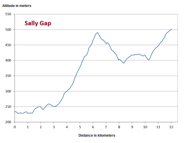
After the first six kilometres, you have almost reached the final altitude, but then it's another 100 metres downhill and only then up to the top of the pass.

It starts in the village of Roundwood.
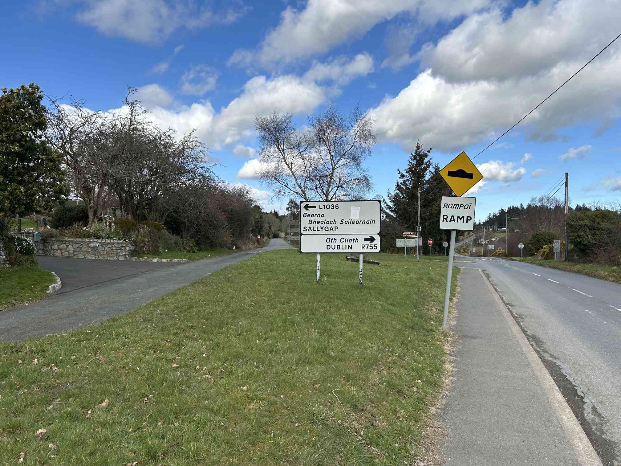
At the end of the village, turn left here.
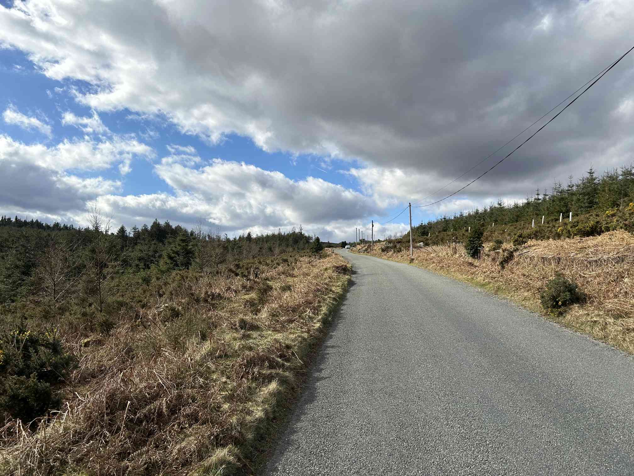
And then it's a leisurely climb for a few kilometres. However, if you have already struggled up the brutally steep Mount Leinster in the morning, then this is anything but a leisurely ride.
After the halfway point (there is a large car park on the right, not shown here), the road climbs steeply.
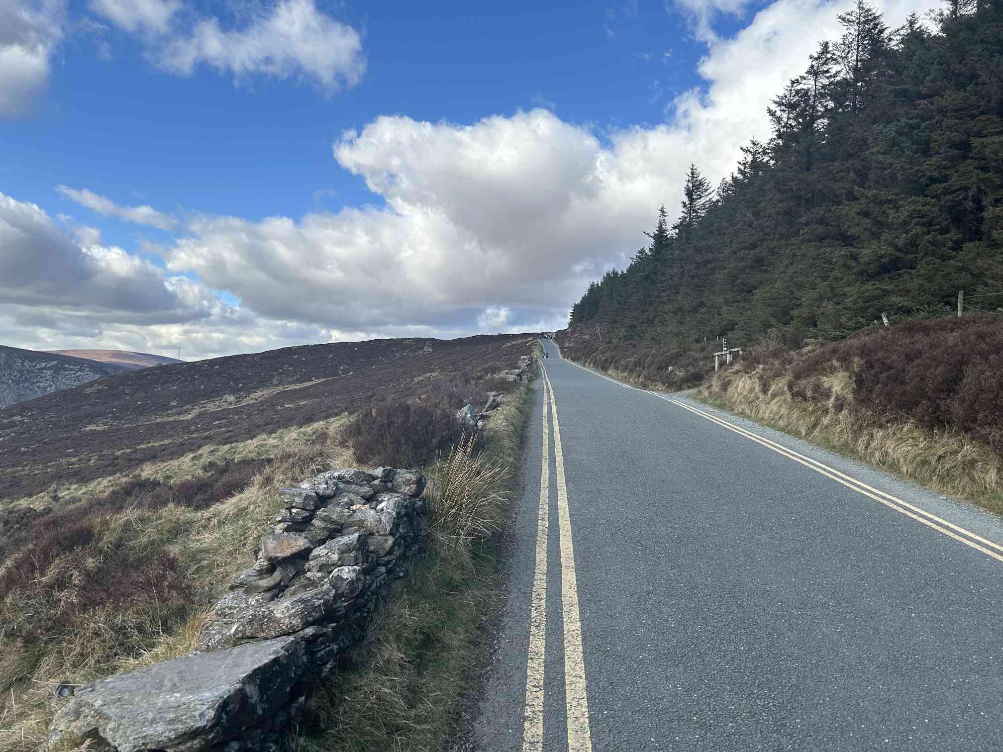
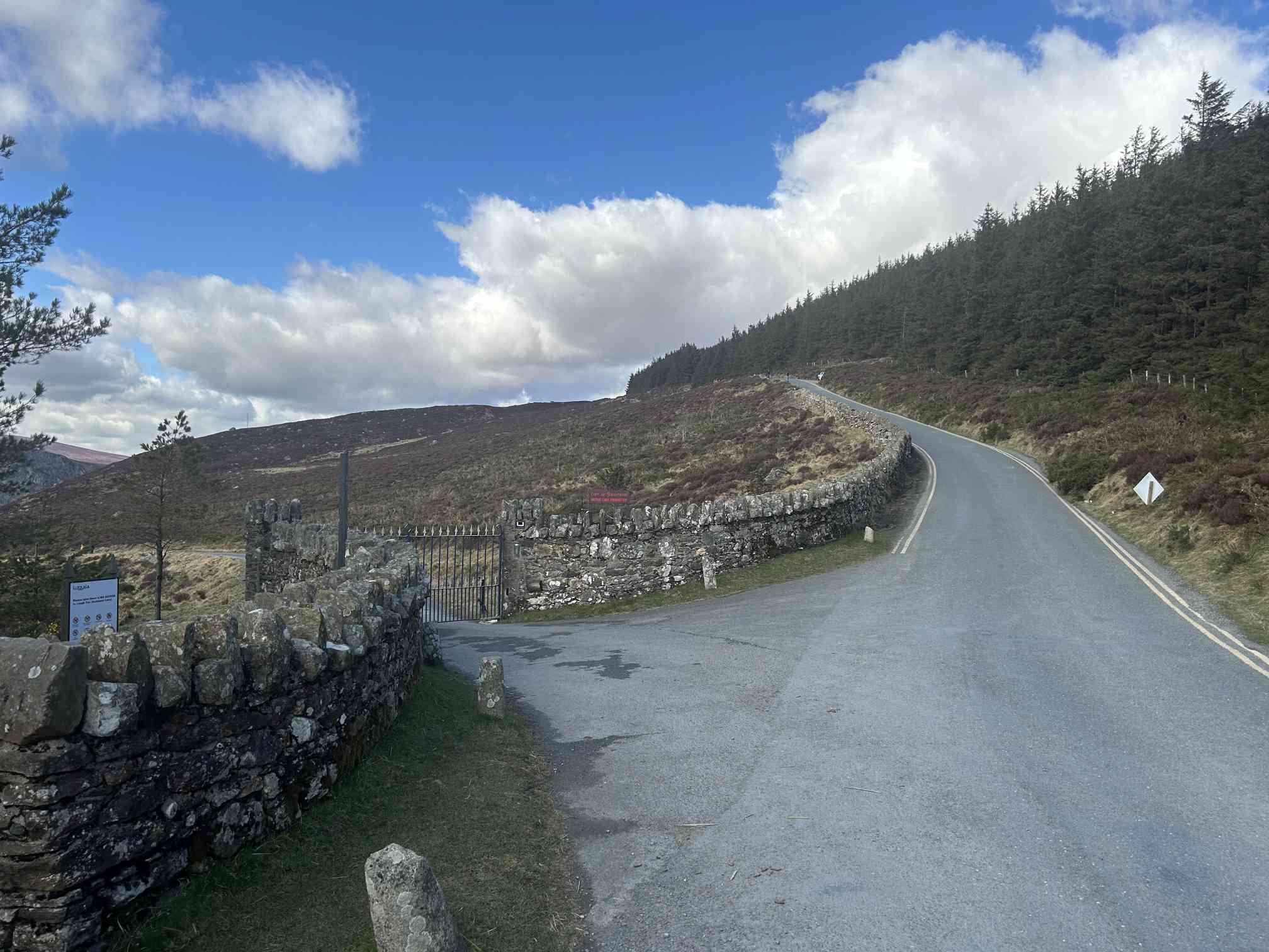
And surprisingly, a wide plateau with a moorland landscape opens up.
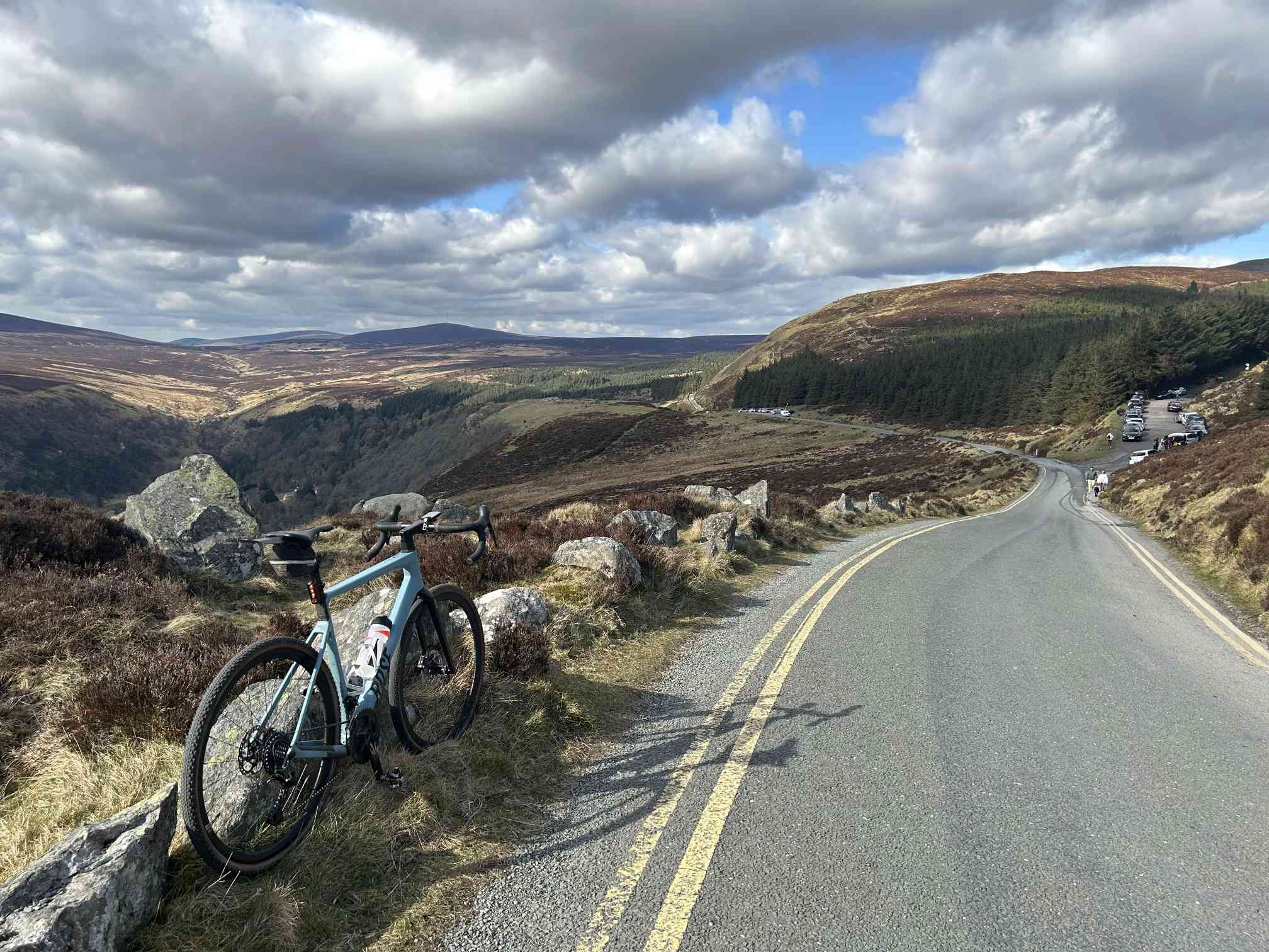
Wow, that was unexpected. Here the route first descends again and at the far end of the horizon you can see the ascent to Sally Gap.
The 'green' island is still pretty grey and brown in the middle of March - but still beautiful.
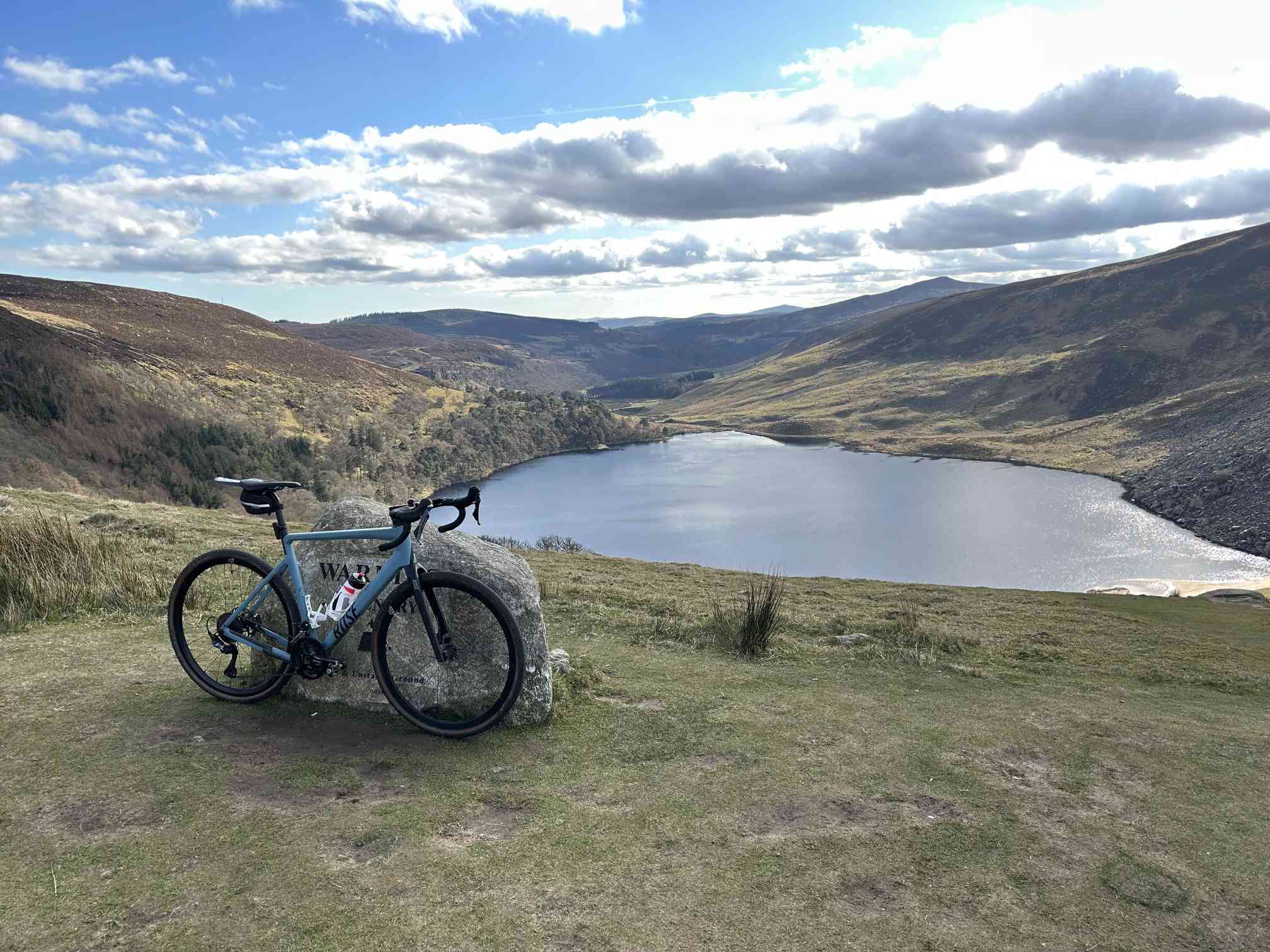
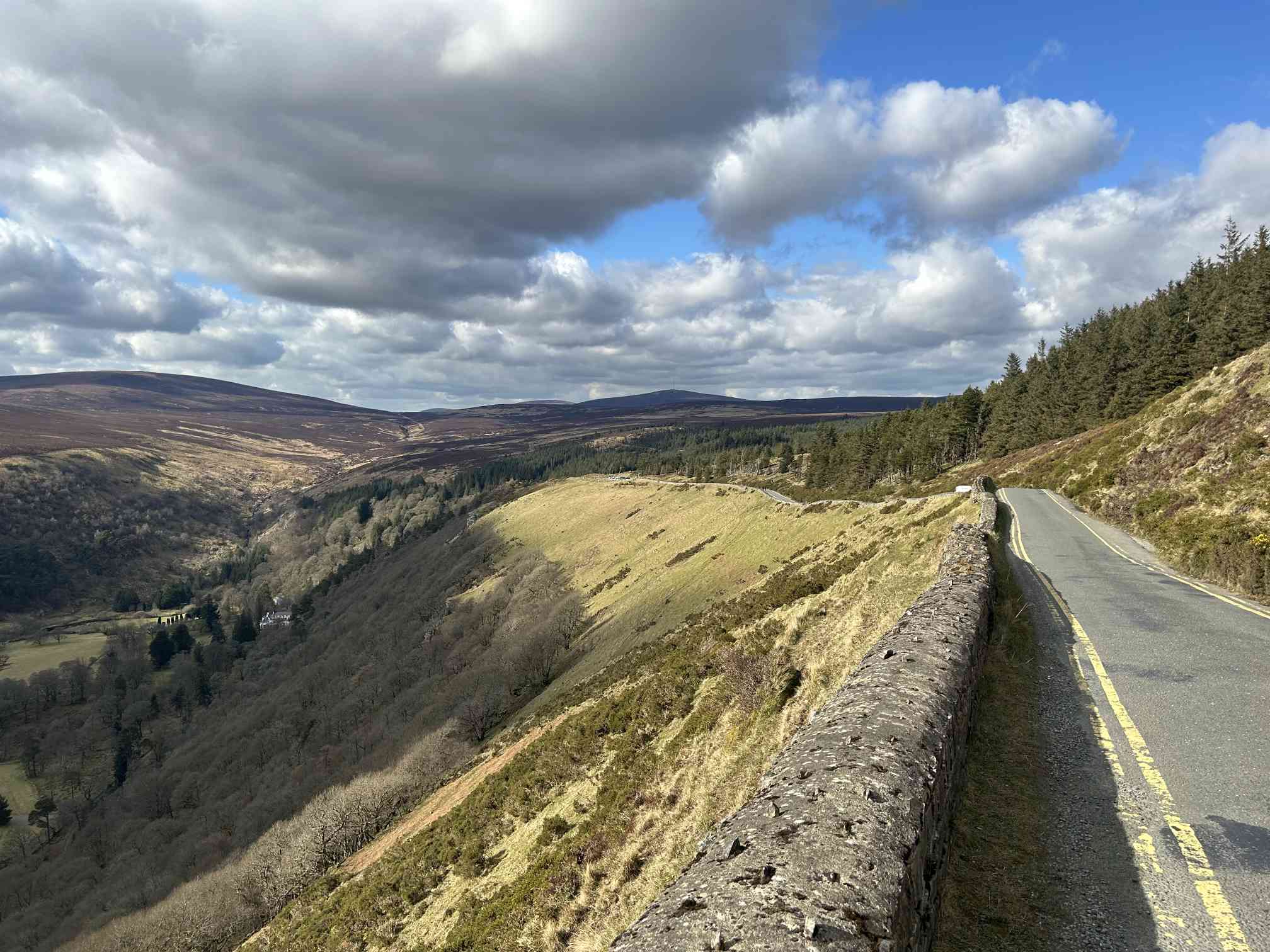
We pass the imposing Lough Tay.
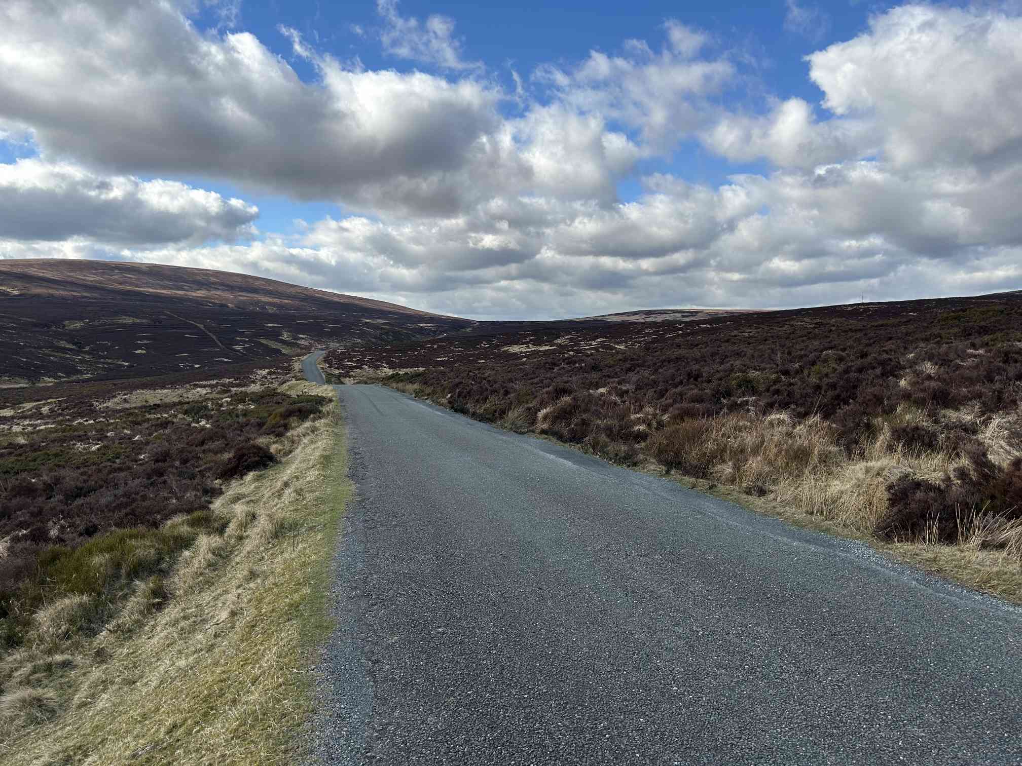
We continue through the heathland.
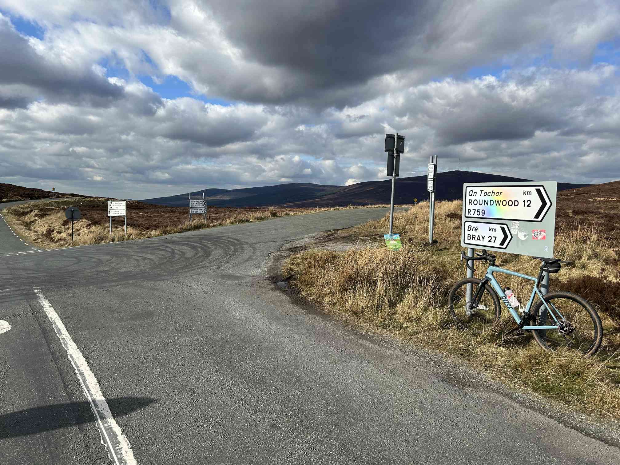
And finally we reach the top of the pass after an unexpectedly beautiful tour, unfortunately much too short.


