EN
DE


Welcome to the cutting-edge of uphill cycling
and world's most famous ascents of each of the continents


Welcome to the cutting-edge of uphill cycling
and world's most famous ascents of each of the continents
| Andalusia | |||
 | Mulhacen | 3,482m | |
| | Pico del Veleta | 3,394m | |
| | Pico del Veleta | 3,394m | |
| | O Sel Ling | 1,462m | |
 | Gibraltar Rock | 426m | |
| Canary Islands & Madeira | |||
| | Roque Muchachos | 2,426m | |
| | Tabonal Negro (Teide) | 2,362m | |
| | Pico de las Nieves | 1,945m | |
 | Pico do Arieiro | 1,802m | |
| | C. Pedro Gonzales | 490m | |
| Pyrenees | |||
 | Port d'Envalira | 2,408m | |
| | Ordino Arcalis | 2,232m | |
 | Col du Tourmalet | 2,115m | |
| | Col d'Aubisque | 1,709m | |
| | Col de Peyresourde | 1,569m | |
| | Col d'Aspin | 1,489m | |
| | Col du Soulor | 1,450m | |
| Mallorca | |||
| | Puig Major | 1,433m | |
| | Sa Calobra | 718m | |
| | Coll d'Honor | 550m | |
| | San Salvador | 510m | |
| | Coll de Sóller | 497m | |
| | Port de Valdemossa | 323m | |
| | Cap de Formentor | 225m | |
| Giant Mountains & Ore Mountains | |||
 | Sniezka | 1,602m | |
 | Modré Sedlo | 1,500m | |
| | Vrbatova Bouda | 1,400m | |
 | Klinovec | 1,244m | |
 | Fichtelberg | 1,215m | |
| | Spindlerpass | 1,200m | |
| Balkans | |||
 | Štulac Sedlo | 1,957m | |
| | Durmitor Sedlo | 1,908m | |
 | Kopaonik | 1,805m | |
 | Sveti Jure | 1,762m | |
 | Qafa Thores | 1,681m | |
 | Visočica Sedlo | 1,625m | |
 | Galičica Sattel | 1,564m | |
 | Prevalac | 1,560m | |
| | Qafa Bordolecit | 1,355m | |
| | Krstac | 958m | |
| Scandinavia | |||
 | Juvasshytta | 1,851m | |
| | Dalsnibba | 1,459m | |
 | Flatruet | 975m | |
| | Trollstigen | 866m | |
| | Ørnevegen | 623m | |
 | Muotkatakka | 565m | |
 | Halfdan | 504m | |
| | Kleifaheidi | 413m | |
 | Møllehøj | 171m | |
| Baltics | |||
 | Suur Munamägi | 318m | |
 | Gaizinkalns | 312m | |
 | Aukštojas | 294m | |
| Benelux | |||
 | Botrange | 694m | |
 | Kneiff | 560m | |
 | Vaalserberg | 323m | |
| Great Britain & Ireland | |||
 | Great Dun Fell | 848m | |
 | Mount Leinster | 793m | |
 | Lowther Hill | 724m | |
| | Cairnwell Pass | 670m | |
 | Bwlch y Groes | 550m | |
| | Bwlch Pen-y-Feidiog | 530m | |
| | Sally Gap | 501m | |
 | Spelga Dam | 404m | |
| European micro states | |||
| | Port d'Envalira | 2,408m | |
 | Pfälzerhütte | 2.108m | |
 | Monte Titano | 652m | |
 | Dingli Cliffs | 245m | |
 | Chemin Révoires | 164m | |
 | Vatican Hill | 77m | |
| Carpathians | |||
 | Transalpina | 2,145m | |
| | Transfagarasan | 2,042m | |
 | Sliezsky Dom | 1,670m | |
| Cornesti Hills (Moldova) | |||
 | Balanesti Hill | 429m | |
| Voras Mountains (Greece) | |||
 | Voras Ski Center | 2.074m | |
| Yildiz Mountains (Turkey) | |||
 | Mahya Dagi | 1,031m | |
| Serra da Estrela (Portugal) | |||
 | Pico Torre | 1,993m | |
| Trodoos Mountains (Cyprus) | |||
 | Olympos | 1,950m | |
| Matra Mountains (Hungary) | |||
 | Kekestetö | 1,014m | |
| Rila Mountains (Bulgaria) | |||
 | Kalin reservoir | 2,550m | |
| Germany | |||
| | Osterfelderkopf | 2,032m | |
| | Nebelhorn | 1,932m | |
| | Alpe Schlappold | 1,740m | |
| | Eagle's Nest | 1,716m | |
| | Roßfeld-Höhenring | 1,540m | |
| | Riedbergpass | 1,420m | |
| | Feldberg | 1,493m | |
| | Fichtelberg | 1,215m | |
| | Brocken | 1,142m | |
| | Salwert | 11m | |
| Great Caucasus (Georgia) | |||
 | Abano Pass | 2,865m | |
| | Gergeti Trinity | 2,170m | |
| Andes | |||
 | Uturuncu | 5,768m | |
| | Chacaltaya | 5,300m | |
| | Salar de Uyuni | 3,650m | |
| | Yungas Death Road | 3,200m | |
| Himalayas | |||
 | Khardung La | 5,602m | |
| | Taglang La | 5,358m | |
| | Potokonkga La | 4,900m | |
| | Namshang La | 4,800m | |
| | Lamayuru Monastery | 3,714m | |
| Rocky Mountains | |||
 | Mount Evans | 4,307m | |
| Sierra del Escambray (Cuba) | |||
 | Topes de Collantes | 755m | |
| Hawaii | |||
| | Mauna Kea | 4,200m | |
| Ethiopian Highlands | |||
 | Tulluu Dimtuu | 4,377m | |
| Alborz-Range (Iran) | |||
 | Dizinpass | 3,257m | |
| | Emamzadeh Davod | 2,929m | |
| Marathon (European Alps) | |||
 | Ötztal Cycle Marathon | 5,209Hm | |
| | La Marmotte | 5,180Hm | |
 | Maratona Dolomites | 4,190Hm | |
| | Dreiländergiro | 3,546Hm | |
 | Alpenbrevet | 3,643Hm | |
| | Alpen-Challenge | 2,499Hm | |
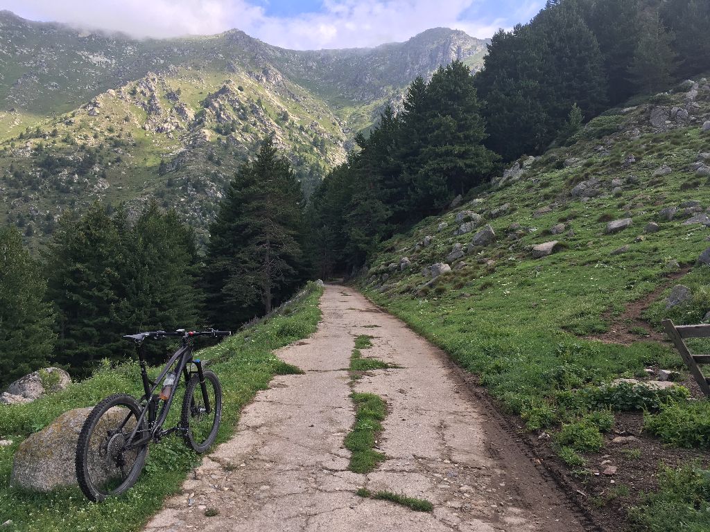
In Bulgarian Rila mountains a private road leads up to the dam of the Kalin water reservoir. In its upper part the road winds through amazing scenery and several hairpins provide for more than 2,000 meters of altitude gain, thus being one of the most demanding climbs in Europe. According to some other internet sources the road is said to be "asphalted". Anyhow, the way is in very sad condition and you should challenge the climb only by mountain bike.
Start: Rila 515m
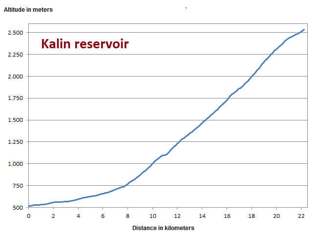
On its first eight kilometers the way overcomes only a few meters of altitude gain. The real climb starts in the small village of Pastra providing a continuous grade of 12% on 15 kilometers.
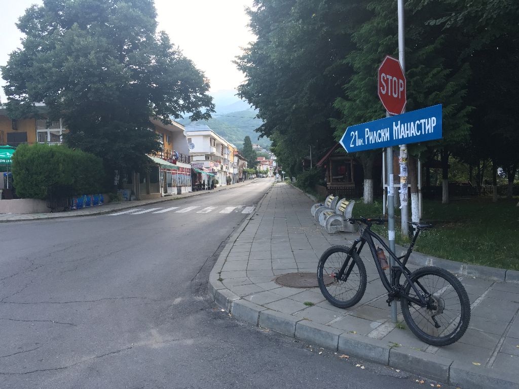
Departure in the centre of Rila village, being well-known for its monastery - an UNESCO world heritage site
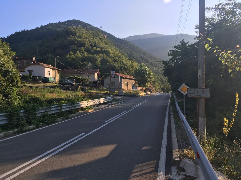
The smooth asphalted road leads to the village of Pastra. At this spot you have to turn left directly into the climb.
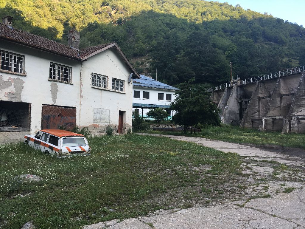
After some 1,000 meters you have reached a first very small reservoir dam.
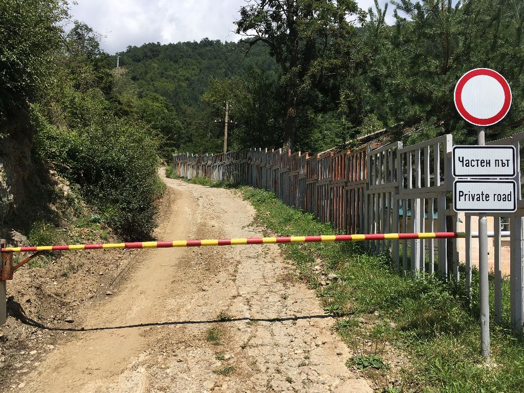
Oops?! Just push the bike beneath the barrier and move on :-)
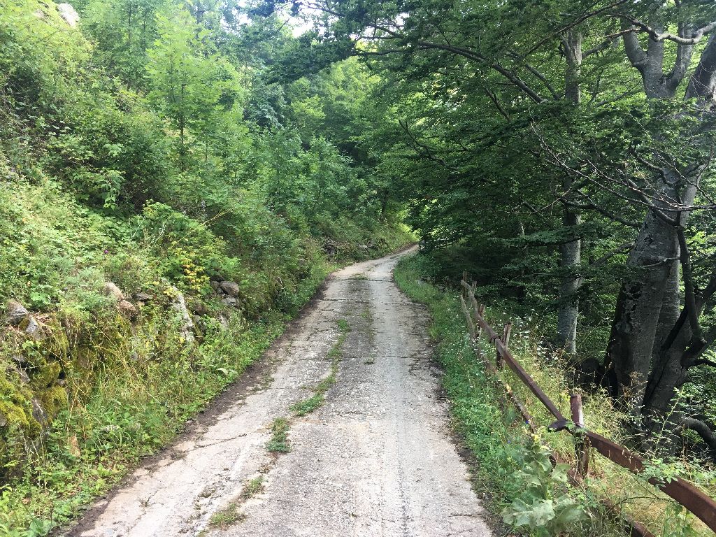
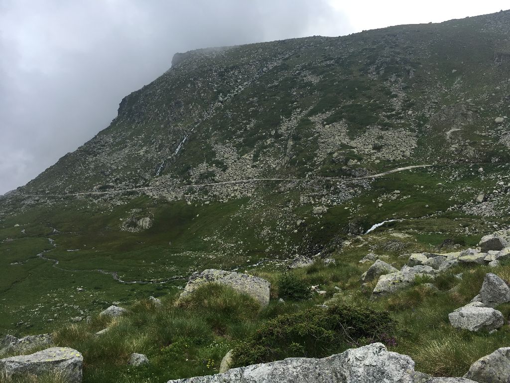
The grade inclines rapidly and the way leads through shady forest.
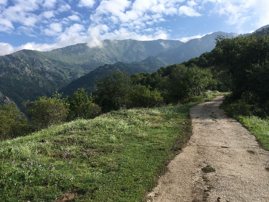
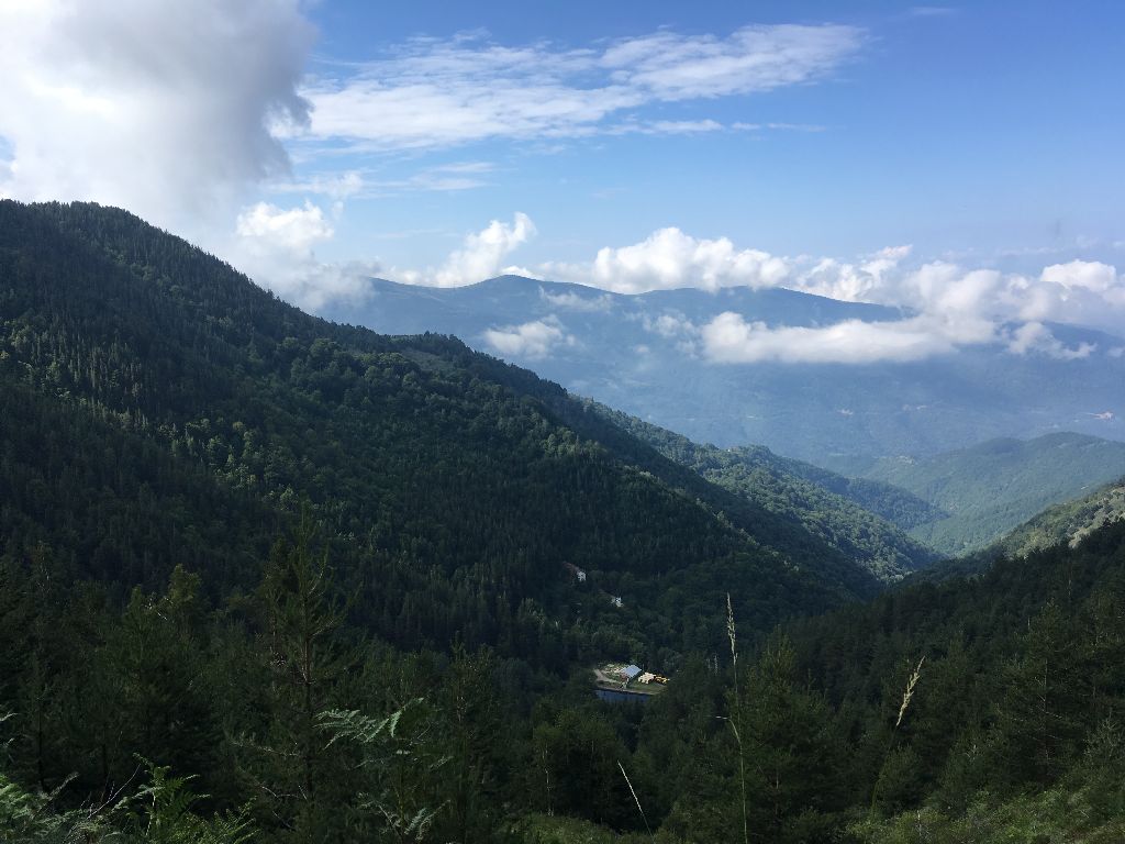
Only few parts of the way provide views to the surrounding area.
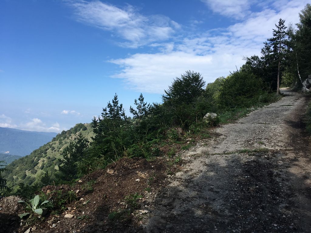
It becomes very steep at some 1,500m of altitude.
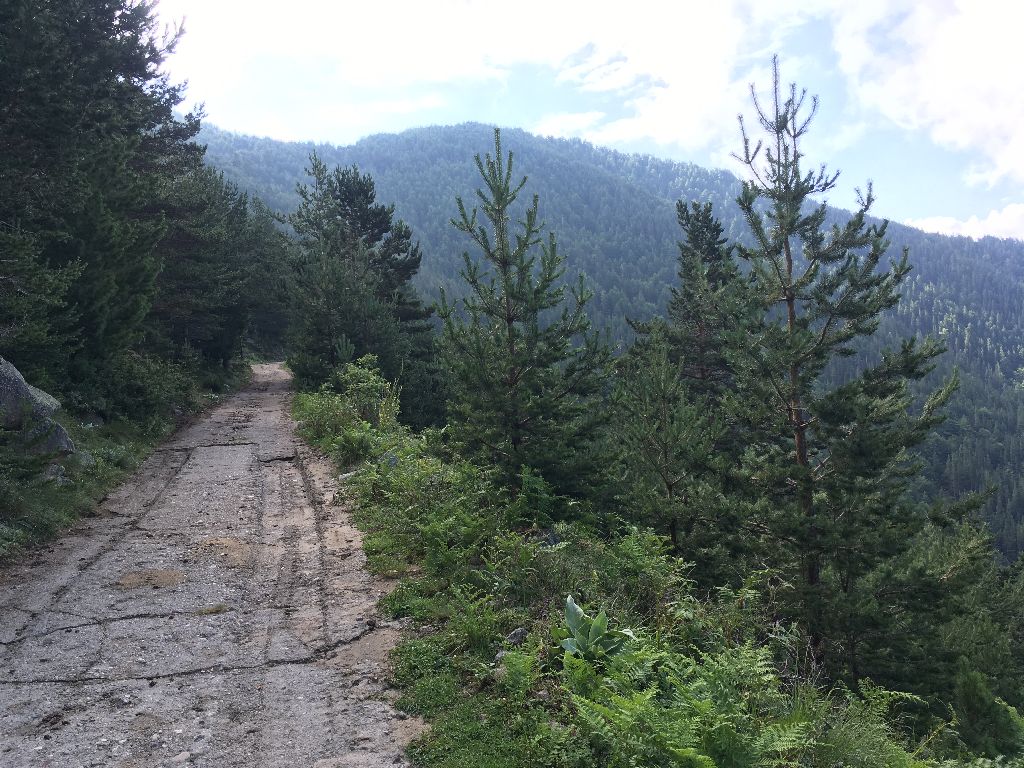
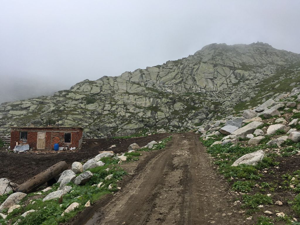
The way is in very poor condition. The road used to be concreted in the past but has become eroded and porous. Many passages with only loose stones and deep potholes cause the cyclist to ride carefully.
View down to the way in the woods
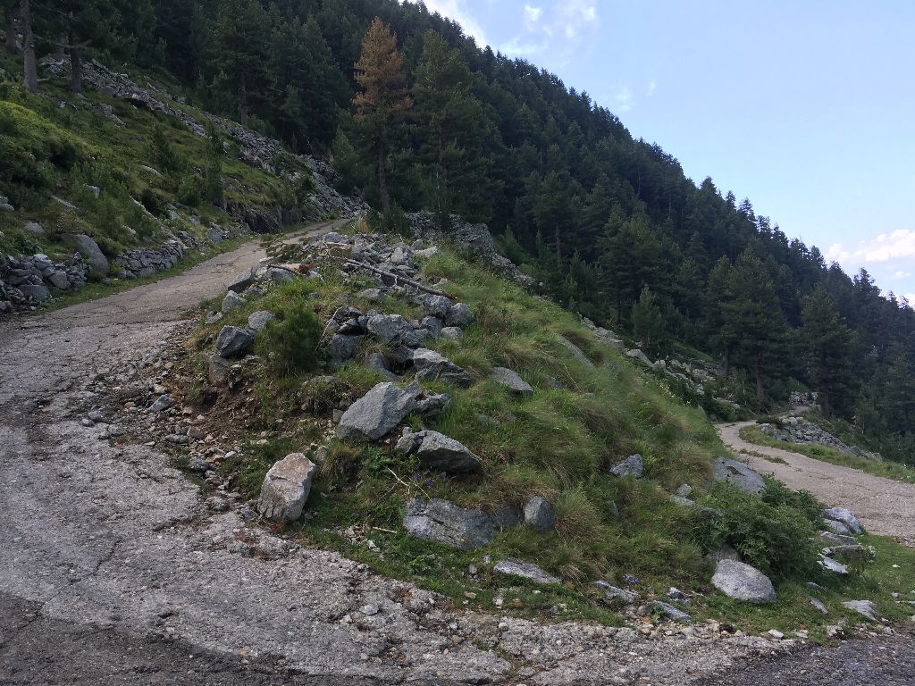
The timberline is reached at some 1,800m.
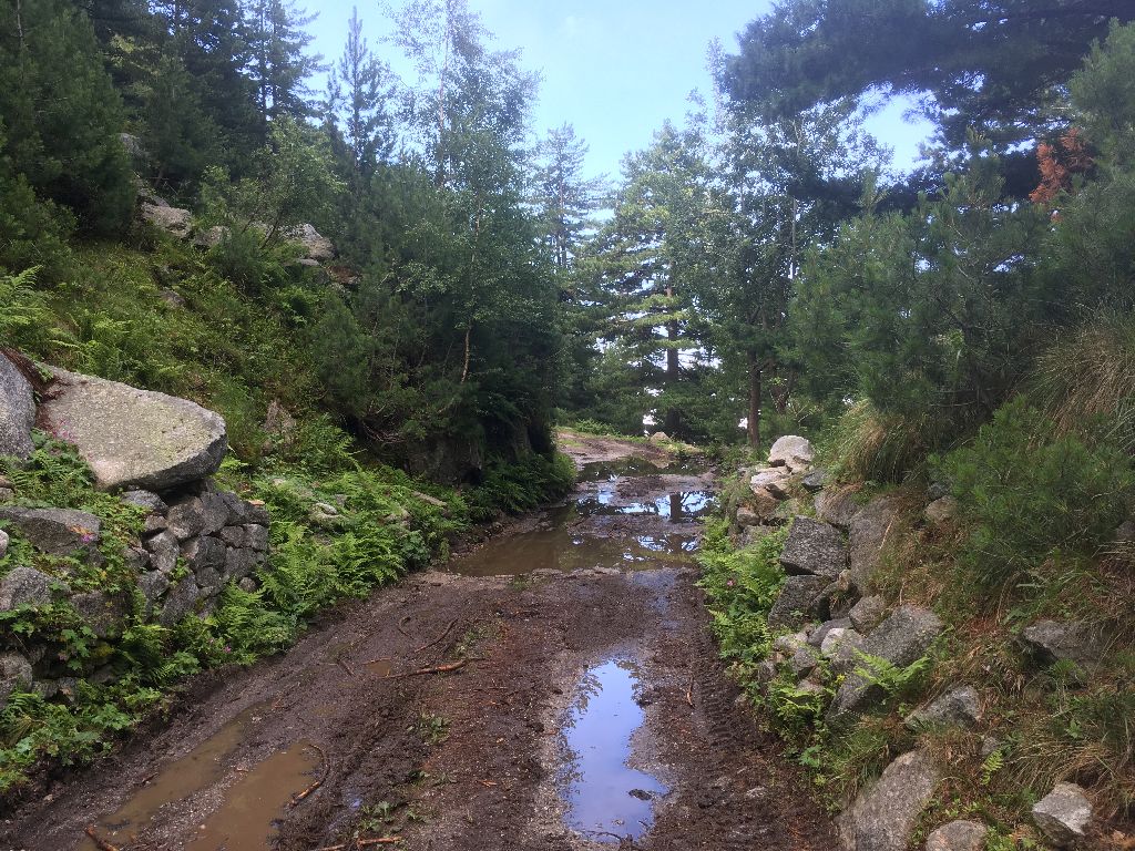
Rather wet conditions in some parts of the road
The real cycling fun begins right here: 12 narrow hairpins wind up the steep climb.
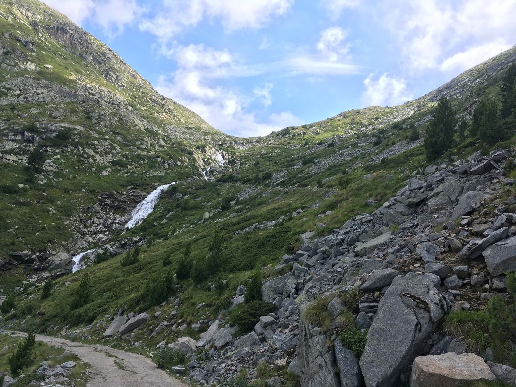
View to the top: Scenic waterfall alongside the way
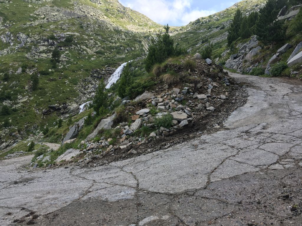
Zig-zagging the uphill climb
Only few flat meters on the way
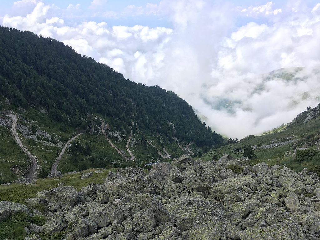
Wow! The group of curves seen from above. Unfortunately, clouds approach very fast from below.
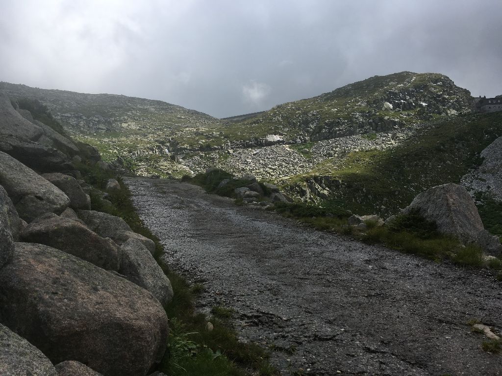
In the center of the image the wall of the reservoir dam. The way proceeds to the right.
According to other sources it is an "asphalted" road...
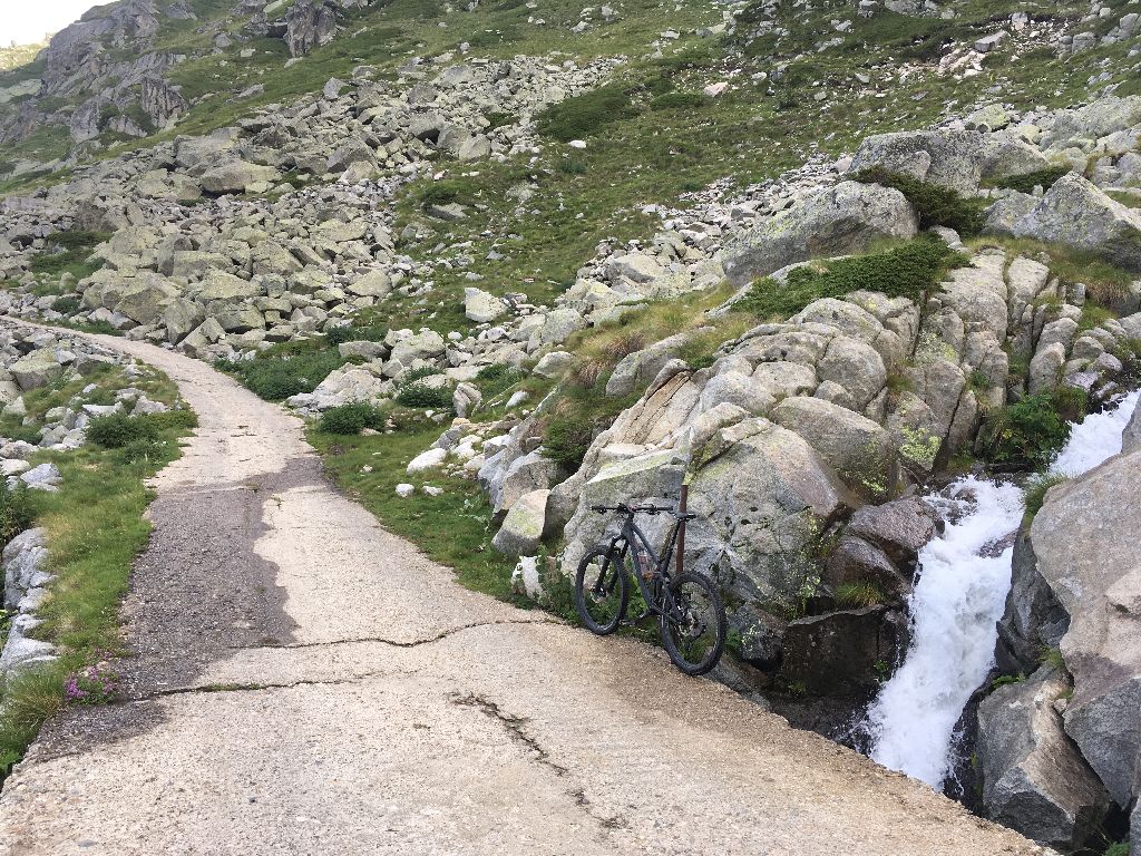
View back onto the way
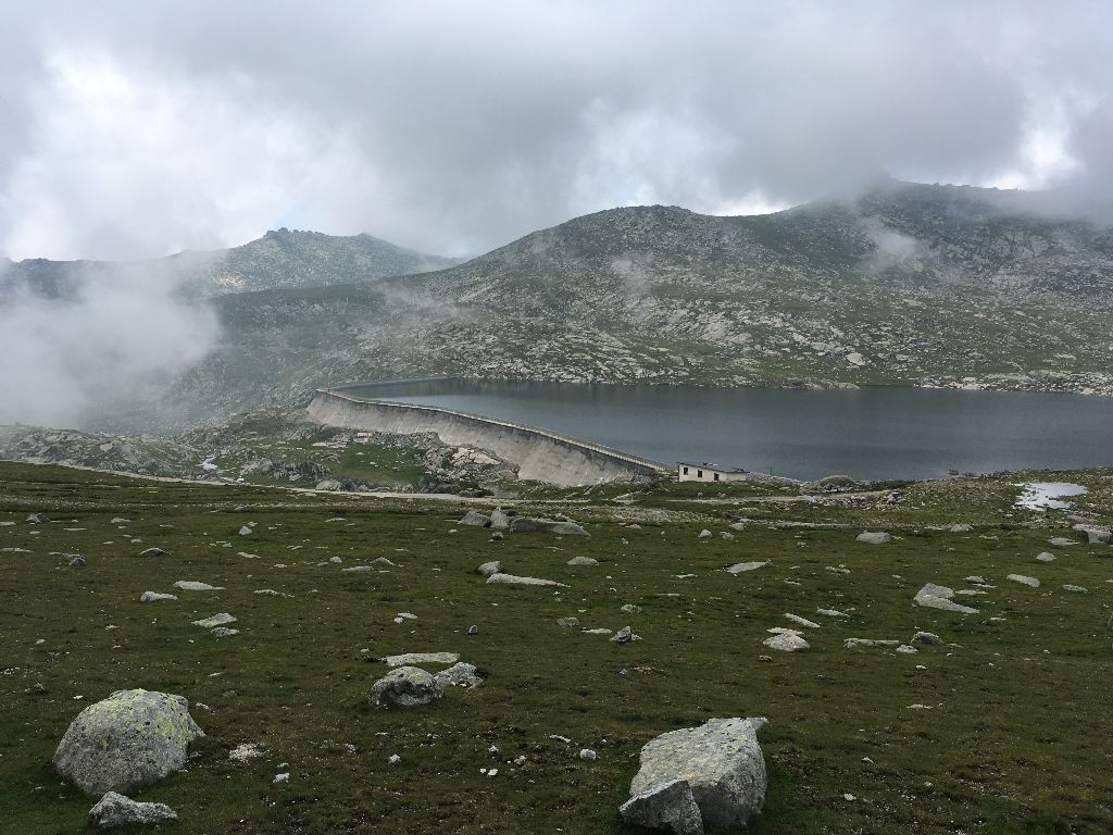
After several hours of exhausting climbing and more than 2,000m of altitude difference we have finally reached the reservoir lake.
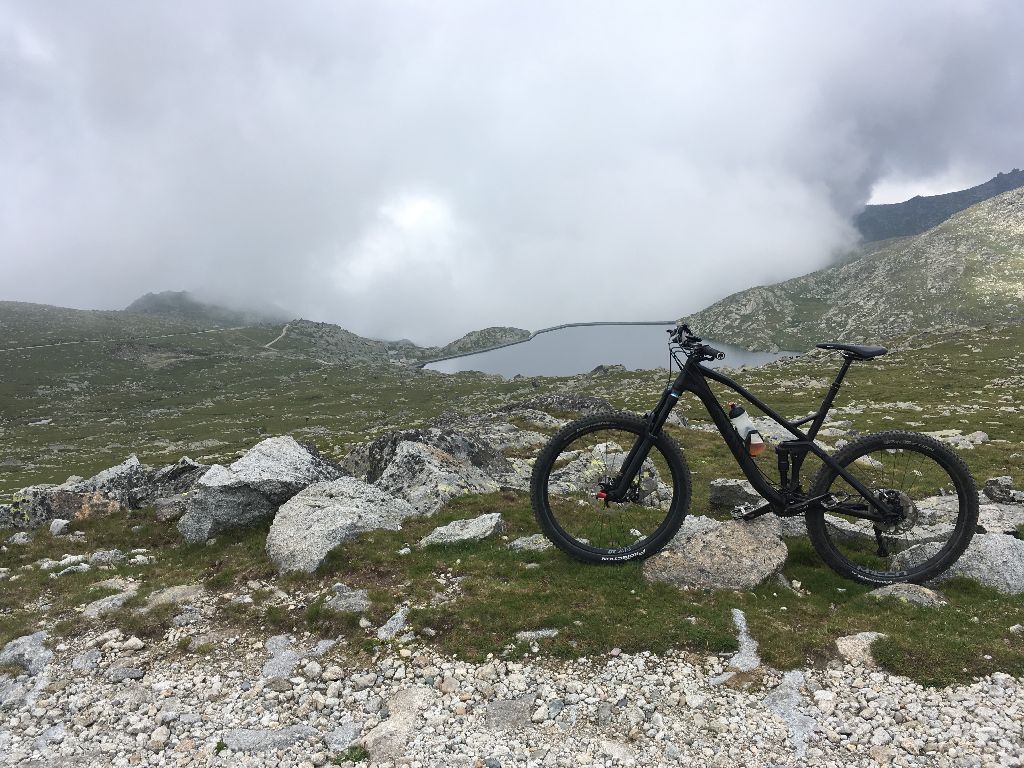
The maximum elevation is some 2,550m at this spot.
360 degree panorama view at the highest spot above the reservoir lake


