| asphalted | unpaved | ||||
| South America: |  Chivay-Arequipa / Peru Chivay-Arequipa / Peru | 4,910m |  Uturuncu / Bolivia Uturuncu / Bolivia | 5,768m | |
| Asia: |  Umling La / India Umling La / India | 5,798m |  Mig La / India Mig La / India | 5,913m | |
| Africa: |  Dodola-Dinsho / Ethiopia Dodola-Dinsho / Ethiopia | 3,610m |  Tulluu Dimtuu / Ethiopia Tulluu Dimtuu / Ethiopia | 4,377m | |
| North America: |  Mount Evans / USA Mount Evans / USA | 4,307m |  White Mountain Peak / USA White Mountain Peak / USA | 4,344m | |
| Oceania: |  Mauna Loa / Hawaii (USA) Mauna Loa / Hawaii (USA) | 3,397m |  Mauna Kea / Hawaii (USA) Mauna Kea / Hawaii (USA) | 4,200m | |
| Europe: |  Pico del Veleta / Spain Pico del Veleta / Spain | 3,394m |  Mulhacen / Spain Mulhacen / Spain | 3,482m | |
| France: |  Cime de la Bonette Cime de la Bonette | 2,802m |  Col du Jandri Col du Jandri | 3,150m | |
| Italy: |  Stilfser Joch Stilfser Joch | 2,758m |  Theodulpass Theodulpass | 3,332m | |
| Switzerland: |  Umbrailpass Umbrailpass | 2,503m |  Hohtälli Hohtälli | 3,286m | |
| Austria: |  Ötztal Glacier Road Ötztal Glacier Road | 2,822m |  Gaislachkogel Gaislachkogel | 3,040m | |
| Germany: |  Alpe Schlappold Alpe Schlappold | 1,740m |  Osterfelderkopf Osterfelderkopf | 2,032m | |
| asphalted | ||
| South America |  Chivay Road Chivay Road | 4,910m |
| Asia |  Umling La Umling La | 5,798m |
| Africa |  Dinsho Road Dinsho Road | 3,610m |
| North America |  Mount Evans Mount Evans | 4.307m |
| Oceania |  Mauna Loa Mauna Loa | 3,397m |
| Europe |  Pico del Veleta Pico del Veleta | 3,394m |
| France |  Cime Bonette Cime Bonette | 2,802m |
| Italy |  Stilfser Joch Stilfser Joch | 2,758m |
| Switzerland |  Umbrailpass Umbrailpass | 2,503m |
| Austria |  Ötztal Glacier Ötztal Glacier | 2,822m |
| Germany |  Alpe Schlappold Alpe Schlappold | 1,740m |
| unpaved | ||
| Southamerica |  Uturuncu Uturuncu | 5,768m |
| Asia |  Mig La Mig La | 5,913m |
| Africa |  Tulluu Dimtuu Tulluu Dimtuu | 4,377m |
| Northamerica |  White Mountain White Mountain | 4,344m |
| Oceania |  Mauna Kea Mauna Kea | 4,200m |
| Europe |  Mulhacen Mulhacen | 3,482m |
| France |  Col du Jandri Col du Jandri | 3,150m |
| Italy |  Theodulpass Theodulpass | 3,332m |
| Switzerland |  Hohtälli Hohtälli | 3,286m |
| Austria |  Gaislachkogel Gaislachkogel | 3,040m |
| Germany |  Osterfelderkopf Osterfelderkopf | 2,032m |
Any search for world's highest bikeable roads is currently subject to disruptive changes due to increasing use of electric mountain bikes. Additionally, the search is mainly characterized by indefinable actual
altitudes of respective roads. Relevant literature, maps and information on the internet
provide many thousands of (often questionable and conflicting) results. In particular in the Himalayas, in the Andes and in Africa new roads are constantly under construction and actual trafficability of such roads
is subject to changes of political and climate conditions in these areas. And some of existing high altitude runways deteriorate more and more. In addition, regular introduction of new light carbon materials, lower standard gears both at mountain bikes and road bikes and the use of electric bikes give the opportunity to climb higher altitudes than in the past.
Besides the Himalayas the Bolivian Altiplano and the Chilean Atacama desert are respective areas with highest roads in the world. In the past such roads were built to reach
sulphur mines in an elevation of more than 5,000 meters. In recent times new astronomical
observatories have been established in the Atacama Desert including runways leading to the
facilities in respective altitudes.
 In terms of accurate altitude measurement it should be considered that both GPS and barometric altimeters have their respective weaknessess. GPS provides incorrect results if in dead spots too less satellites are available for measurement. In this case only global position can be
determined exactly but you can not rely on the reported elevation. Thus popular GPS-devices do actually not determine actual elevation by GPS but by an integrated barometric altimeter.
Anyhow, interaction of
GPS and barometric altitude data in numerous travel reports, the contour lines in Google
Maps and the elevation data in Google Earth provide a reasonably reliable picture of the
actual situation.
In any case the fundamental question is whether a route is uphill passable on
a bicycle, at all. Of course, you can partly ride, push and carry your bike cross country and
thus reach any mountain peak. This may even lead in some cases to reported heights of more
than 6,000 meters in Bolivia, Ladakh/India or in particular at Ojos del Salado/Chile. However, present search for the highest roads follows the simple idea that a road is continuously uphill bikeable
if also a motorized two-lane vehicle finds its way on a route designated for that purpose - but actually even these runways are not always cyclable.
Europe
 If you want to climb great heights in Europe by bike, you should not only look at the Alps, but also and especially at the Spanish Sierra Nevada in Andalusia. The road paths to Pico del Veleta (3,394m) and Mulhacen (3,482m) are accessible by road bike and mountain bike, respectively, and represent the highest and longest climbs in Europe. However, Mulhacen is closed to mountain bikers.
In the Alps, the El Dorado for high-altitude riders lies on the Breithorn massif in the border region between Switzerland and Italy. Within a radius of around 20 km, extremely challenging mountain bike climbs lead to the Theodulpass (3,332m), the Hohtälli (3,286m), the Hohsaas (3,142m), the Rothorn (3,103m) and the Gornergrat (3,089m).
The even more adventurous riders can climb their fat bikes on glaciated Breithorn plateau up to the Gobba di Rollin (3,899m). However, Swiss piste police may stop you and impose a fine of 200 Swiss Francs.
The 3,000m limit can also be exceeded by mountain bike on the French trails to Col du Jandri (3,150m) and Mont Chaberton (3,131m). In South Tyrol, unpaved ways lead to the Madritschjoch (3,123m) and the Ortlerhaus (3,025m). And in the Ötztal Alps gravel paths lead to the Gaislachkogel (3,040m) and Wurmkogel (3,023m) at corresponding heights. All the 3,000m peaks mentioned above provide for unavoidable pushing passages for hobby cyclists (without motor support).
The easiest 3.000m climb in the Alps is Italian Colle Sommeiller (3,009m) - if it actually reaches 3.000m at all.
For racing cyclists the highest climbs in the Alps lead to the Ötztal Glacier (2,822m), the Cime de la Bonette (2,802m) and the Col de l'Iseran (2,770m). The magical 2,500m limit can be challenged in the Alps on about ten asphalted ramps (depending on how you count them) .
Germany: It is quite hard to determine Germany's highest spot reachable by road bike. Highest public accessible asphalted German road for motorised traffic is Roßfeld-Höhenringstraße (1,540m) near Berchtesgaden. Even higher is the close-by non-public asphalted road up to the parking area at Kehlsteinhaus / Eagle's Nest (1,716m). But unfortunately this roadway is not permitted to cyclists but only to tourist coaches. However, there is an alternative old military road leading up to Eagle's Nest which can be accessed by mountain bike.
From Oberstdorf an asphalted and very steep roadway leads at Fellhorn Mountain to Alpe Schlappold at 1,740m which is closed to non-authorised motorised traffic but is attainable on a bicycle. Close-by a further paved hiking way winds via Edmund-Probst-Haus (1,932m) at Nebelhorn mountain to an eleavtion of more than 2,000 meters. However, this last runway is in parts extremely steep and thus considered not cyclable by many riders. In addition, mountain bikers can challenge a gravel runway up to Osterfelderkopf (2,022m) and mountain station of Garmisch Alpspitzbahn.
Austria: Road bikers can find three paved mountain roads in Austria with their peaks above 2,500 meters. From Sölden in Ötz Valley a steep ramp leads up to Ötztal Glacier (2,822m). And northern approach to Timmelsjoch (2,509m / actually 2,474m) also starts from Sölden. Further high Austrian climbs are Großglockner High Alpine Road (2,571m) and asphalted road up to Kaunertal Glacier (2,750m).
At Gaislachkogel (3,040m) bikers can reach an altitude of more than 3,000m by mountain bike.
Switzerland: Highest asphalted Swiss road pass is Umrailpass (2,503m) at the border to Italy close to Stelvio Pass. However, all other passroads entirely situated within Switzerland stay shortly below 2,500 meters. The highest of these is Nufenenpass (2,478m).
Strong mountain bikers can climb Hohtälli (3,286m) up to an elevation of almost 3,300m.
Italy: Northern climb of Stelvio Pass (2,758m) is not only Italy's highest paved passroad but one of Europe's most viewy ascents. In addition road bikers can challenge the eastern ascent of Colle dell'Agnello (2,744m), the Gaviapass (2,652m) and finally Colle del Nivolet (2,612m).
And Theodulpass (3,332m) is the highest accessible spot for mountain bikers in Italy and in the Alps.
France: Highest French spot accessible by road bike is Cime de la Bonette (2,802m) shortly above the pass of the same name. However, highest real asphalted French passroad is Col de l'Iseran (2,770m), followed by western flank of Col Agnel (2,744m) and legendary Col du Galibier (2,645m).
One of the highest unpaved roads in the Alps is the climb to Col du Jandri (3,150m).
South America
At Chilean volcano Ojos del Salado the Refugio Tejos (5,820m) can be accessed through a dirt track runway using a motorized 4x4 car. This route even proceeds to a maximum elevation of some 5,900 meters. Beyond this point several elevation world records have been set by all-terrain vehicles or by using using fat-tyred mountain bikes. However, the runway up to Refugio Tejos is said to be very rocky and sandy and provides an average gradient of 15% on its last kilometers. Thus this way is actually deemed not rideable with an ordinary bike.
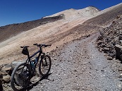 Current South America's highest cyclable road is located in the southwest of Bolivia and leads up to the mountain saddle of double-peaked volcano Uturuncu with its peak elevation of 5,768 meters. Until the 1990s there was a sulphur mine at the volcano which could be accessed by using this mine road. Nowadays the runway is only maintained by few local tourist guides. Thus this way is currently not blocked by landslides (as indicated in several trip reports) but motorable up to the mountain saddle (November 2013). After a reasonable time of acclimatisation this climb is actually cyclable.
Besides Uturuncu the current situation at Chilean/Bolivian volcano Acotango is interesting. Due to sulphur mining activities on top of this mountain the old Bolivian mine road has been renewed in recent years and work at this road is still in progress. Independent sources report the actual end of this road at a GPS measured elevation of some 5,700m. Road conditions are said to be more trafficable than at Uturuncu.
At Chilean volcano Aucanquilcha there was in the past a sulphur mine at an altitude of even above
6,000 meters and a dead-end road was leading up there. However, as the mine is no longer in operation the road currently deteriorates and is thus reported to
be partly blocked and no longer trafficable above 5,500 meters. At close-by active volcano Ollague there is still some sulphur mining both on Bolivian and Chilean side of the mountain. On both sides unpaved roads lead up to the respective mines at an elevation of 5,500m. The same height can be accessed on a gravel way at volcan Tacora in the border area of Chile and Peru.
All these mentioned roads can be identified on satellite images and Google Maps/Earth confirm respective altitudes.
Another rideable runway is the unpaved dead-end road in La Paz/Bolivia up to the former
ski area Chacaltaya (5,200 meters / 17,061 ft).
And some 250 kilometers northwest of La Paz the world's highest town is situated in Peru: La Rinconada (5,100 meters / 16,733 ft) can be accessed through a dirt track road. In addition there are several other nameless passroads in Peru's provinces of Arequipa and Apurimac said to exceed 5,000 meters at their peaks.
Further high spots can be found on the plateau of Chilean Atacama desert, driest desert in the
world. Due to the climate conditions in that stone desert several astronomical observatories
have been erected there in the past. The Atacama Large Millimeter/submillimeter Array (ALMA) site with its several astronomical facilities is located there. On Cerro Chajnantor at an elevation of 5,612 meters / 18,412 ft several universities currently construct the Cornell Caltech Atacama Telescope (CCAT).
Satellite images and photographs on the CCAT-website clearly show a trafficable runway up to the facility. However, whole area is non-public and access is ALMA-controlled. On enquiry CCAT and ALMA representatives unfortunately refuse any access to Cerro Chajnantor
and a fence actually blocks the road. Nearby at Cerro Sairecabur a mobile Receiver Lab
Telescope can be found at an altitude of 5,525 meters / 18,127 ft. This observatory and the
respective road up there can also be clearly identified on satellite images. Pictures on scientific websites providing information on that
observatory show 4x4 cars next to the facility and the satellite images even show that the
road continues up to an elevation of more than 5,600 meters.
Highest paved road in South America is supposed to be Ticlio-Pass/Abra Anticona (4,818 meters / 15,808 ft) east of Lima in Peru.
But asphalted Paso de Jama connecting Argentina with San Pedro de Atacama in Chile has its Chilean peak at an elevation of 4,831 meters / 15,846 ft.
However, there seems
to be an even higher cleanly asphalted route in Peru: The road from Chivay to Arequipa has its peak apparently at 4,910 meters / 16,110 ft. Photos on the internet show the
nameless pass summit with a stone sign indicating this altitude and Google Earth/Maps
confirm an elevation of some 4,860 meters - higher than Ticlio-Pass and Paso de Jama!
Asia
The situation in the Asian Himalayas is somewhat unclear. New information and photos of very high mountain passes in the border region between China, India and Pakistan, as well as in Tibet, are constantly emerging, some of which are difficult to verify. Many of these mountain roads have in common that information about their passability and condition is hard to find due to their military strategic importance, and that the passes are largely inaccessible to foreign civilians.
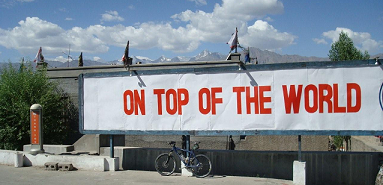
Among the newer accessible passes are Mig La (5,913 m) and neighbouring Umling La (5,798 m) in Ladakh, India, on the border with China, which are now considered the highest motorable roads in the world. Since October 2025, Mig La has also been awarded the title of ‘Highest motorable road in the world’ locally. While Umling La has now been upgraded to a paved road, Mig La is still a gravel road. Both passes can also be conquered by bicycle.
The Mig La is primarily of military significance, but is also intended to be used for tourism. Some caution is advised when it comes to the altitude of 5,913 m. In the past, the responsible Indian authorities have been known to cheat when it comes to the altitude of other passes, and satellite images show that the Mig La ‘only’ reaches around 5,800 m.
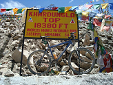 Also in Ladakh, India, the Khardung La (5,602m) had long been wrongly labelled the highest road in the world. This information was not only found locally, but was also repeated countless times in travel reports. However, the official altitude of 5,602 metres was obviously never correct. In fact, it is only around 5,360 metres. It is similarly high in the same area on the tarmac road at Taglang La (5,358m).
In Tibet, some sources classify the Lajiong La (5,821m), which can be recognised on satellite images, as rideable. In addition, the Kiu La (5,711m) or the unpaved road on the Indian/Tibetan border up to the Mana La = Dungri La (>5,600m) are also occasionally mentioned. At the Siachen Glacier in the Pakistan/India/China border region, the Karakoram Pass is usually given as 5,575 metres. And on the Marsimik La in Ladakh, India, it goes up to 5,680m on a dirt track on the border with China. In Tibet, the Semo La (5,565m) and the Suge La (usually indicated as 5,430m / on Google Maps even over 5,500m) are freely accessible.
The classic mountain bike route from Lhasa in Tibet to Kathmandu in Nepal, which is over a thousand kilometres long, also crosses several 5,000 metre passes.
On the Tibetan side, this route is increasingly being developed into a tarmac trunk road and reaches an altitude of 5,220 metres at Gyatso La = Lhakpa La. The road to Everest Base Camp (5,150 metres) on the Tibetan side is now also asphalted throughout and is even offered as a road bike tour by professional agencies.
Africa
Africa's highest roads should be found either in Morocco, in the mountainous East Africa
(Ethiopia, Kenya, Uganda, Tanzania) or in the Drakensberg Mountains in South Africa/Lesotho.
As some of these areas are still not well developed but Third World countries it is hard to
obtain reliable information about conditions and elevations of mountain roads there.
 In Ethiopian Highlands there are several roads with their peaks at an elevation of more than 3,000 meters.
Near Mount Buahit in the Semien Mountains you can even find an unpaved runway with its highest point above 4,000 meters. And in the southeast of Ethiopia an asphalted road leads to the Bale Mountain National Park.
This road has its highest nameless spot at an altitude of 3,610m / 11,844ft between the villages of Dodola and Dinsho.
However, the gravel road through Sanette Plateau in the Bale Mountains National Park is even higher:
A dead-end side road leads to a telecommunication facility on the summit of Mount Tulluu Dimtuu (4,377m / 14,361ft), one of the tallest mountains of the country.
This road is accessible by bicycle.
South African Drakensberg Mountains have their highest summits in embedded Lesotho. There you
can find a paved road through the country with its peak at Tlaeeng Pass (3,251 meters /
10,666 ft). Pictures on the internet show this pass with an asphalted road and the respective
altitude indication. Google Maps/Earth confirms this elevation. The way from South Africa to
Lesotho leads via Sani Pass (2,873 meters / 9,426 ft) and Kotisephola Pass/Black
Mountain Pass (3,240 meters / 10,630 ft) both obviously being only graveled runways.
At Mount Kilimanjaro in Tanzania professional tour operators guide mountain bikers to the summit (5,895m).
However, generally the National Park is completely closed to
cyclists. Thus, you can only ride on a paved road (with murderous motorized traffic) up to
Marangu Gate at some 1,900 meters.
North America
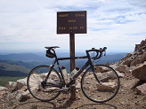 North America's highest roads all exceeding an elevation of 4,300m and accessible by bicycle are mainly situated in the Rocky Mountains in the US State of Colorado. The roads up to the two adjacent peaks Mount Evans
(4,307 meters / 14,131 ft) and Pikes Peak (4,301 meters / 14,112 ft) have always been
competing for tourists and visitors. The road winding to Mount Evans has been continuously paved for a long time and is thus rideable on a road bike. And since 2013 cyclists are also permitted to climb all the asphalted way up to Pikes Peak summit.
Highest gravel road is located in Californian White Mountains: White Mountain Peak (4,344m) can be accessed by mountain bike.
Oceania
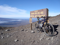 Provided Hawaii belongs geographically to Oceania the partly graveled road up to the
observatory at Mauna Kea volcano (4,200 meters / 13,808 ft) should be the highest bikeable
road on the continent. Face-to-face with Mauna Kea another volcano is located: Mauna Loa has an observatory at its
northern side at an elevation of 3,397 meters / 11,169 ft. This facility is actually accessible
on a narrow but asphalted runway leading through solidified lava up to the observatory.
Otherwise the road up to the ski resort Charlotte Pass (1,840 meters / 6,037 ft) close to
Mount Kosciuszko in Australia should be named the highest road of the continent rideable on a road bike. Whether there are even higher roads in New Zealand or in New Guinea is unknown,
but unlikely anyhow.
Antarctica
Even Antarctica has an unpaved "road": The trafficable snow runway of South Pole Traverse winds 1,500 kilometers from McMurdo Harbour and the Ross Ice Shelf through the Transantarctic Mountains towards the South Pole. The Traverse is used by snow vehicles to provide Amundsen-Scott-Station at the South Pole (2,835m / 9,302ft) with necessary equipment.
On a different route cyclists reached in January 2012 the South Pole for the first time on specifically manufactured bicycles with fat tires. The tour led through the Antarctic Plateau (average height 3,000 meters) and was accompanied by support cars and a television crew. However, the trip was partly realised on skis and with wind sails. And as lowest temperatures in the Antarctic summer decline to some minus 40 degrees Celsius riding on a bicycle may become a little uncomfortable in that region.