EN
DE


Welcome to the cutting-edge of uphill cycling
and world's most famous ascents of each of the continents


Welcome to the cutting-edge of uphill cycling
and world's most famous ascents of each of the continents
| Andalusia | |||
 | Mulhacen | 3,482m | |
| | Pico del Veleta | 3,394m | |
| | Pico del Veleta | 3,394m | |
| | O Sel Ling | 1,462m | |
 | Gibraltar Rock | 426m | |
| Canary Islands & Madeira | |||
| | Roque Muchachos | 2,426m | |
| | Tabonal Negro (Teide) | 2,362m | |
| | Pico de las Nieves | 1,945m | |
 | Pico do Arieiro | 1,802m | |
| | C. Pedro Gonzales | 490m | |
| Pyrenees | |||
 | Port d'Envalira | 2,408m | |
| | Ordino Arcalis | 2,232m | |
 | Col du Tourmalet | 2,115m | |
| | Col d'Aubisque | 1,709m | |
| | Col de Peyresourde | 1,569m | |
| | Col d'Aspin | 1,489m | |
| | Col du Soulor | 1,450m | |
| Mallorca | |||
| | Puig Major | 1,433m | |
| | Sa Calobra | 718m | |
| | Coll d'Honor | 550m | |
| | San Salvador | 510m | |
| | Coll de Sóller | 497m | |
| | Port de Valdemossa | 323m | |
| | Cap de Formentor | 225m | |
| Giant Mountains & Ore Mountains | |||
 | Sniezka | 1,602m | |
 | Modré Sedlo | 1,500m | |
| | Vrbatova Bouda | 1,400m | |
 | Klinovec | 1,244m | |
 | Fichtelberg | 1,215m | |
| | Spindlerpass | 1,200m | |
| Balkans | |||
 | Štulac Sedlo | 1,957m | |
| | Durmitor Sedlo | 1,908m | |
 | Kopaonik | 1,805m | |
 | Sveti Jure | 1,762m | |
 | Qafa Thores | 1,681m | |
 | Visočica Sedlo | 1,625m | |
 | Galičica Sattel | 1,564m | |
 | Prevalac | 1,560m | |
| | Qafa Bordolecit | 1,355m | |
| | Krstac | 958m | |
| Scandinavia | |||
 | Juvasshytta | 1,851m | |
| | Dalsnibba | 1,459m | |
 | Flatruet | 975m | |
| | Trollstigen | 866m | |
| | Ørnevegen | 623m | |
 | Muotkatakka | 565m | |
 | Halfdan | 504m | |
| | Kleifaheidi | 413m | |
 | Møllehøj | 171m | |
| Baltics | |||
 | Suur Munamägi | 318m | |
 | Gaizinkalns | 312m | |
 | Aukštojas | 294m | |
| Benelux | |||
 | Botrange | 694m | |
 | Kneiff | 560m | |
 | Vaalserberg | 323m | |
| Great Britain & Ireland | |||
 | Great Dun Fell | 848m | |
 | Mount Leinster | 793m | |
 | Lowther Hill | 724m | |
| | Cairnwell Pass | 670m | |
 | Bwlch y Groes | 550m | |
| | Bwlch Pen-y-Feidiog | 530m | |
| | Sally Gap | 501m | |
 | Spelga Dam | 404m | |
| European micro states | |||
| | Port d'Envalira | 2,408m | |
 | Pfälzerhütte | 2.108m | |
 | Monte Titano | 652m | |
 | Dingli Cliffs | 245m | |
 | Chemin Révoires | 164m | |
 | Vatican Hill | 77m | |
| Carpathians | |||
 | Transalpina | 2,145m | |
| | Transfagarasan | 2,042m | |
 | Sliezsky Dom | 1,670m | |
| Cornesti Hills (Moldova) | |||
 | Balanesti Hill | 429m | |
| Voras Mountains (Greece) | |||
 | Voras Ski Center | 2.074m | |
| Yildiz Mountains (Turkey) | |||
 | Mahya Dagi | 1,031m | |
| Serra da Estrela (Portugal) | |||
 | Pico Torre | 1,993m | |
| Trodoos Mountains (Cyprus) | |||
 | Olympos | 1,950m | |
| Matra Mountains (Hungary) | |||
 | Kekestetö | 1,014m | |
| Rila Mountains (Bulgaria) | |||
 | Kalin reservoir | 2,550m | |
| Germany | |||
| | Osterfelderkopf | 2,032m | |
| | Nebelhorn | 1,932m | |
| | Alpe Schlappold | 1,740m | |
| | Eagle's Nest | 1,716m | |
| | Roßfeld-Höhenring | 1,540m | |
| | Riedbergpass | 1,420m | |
| | Feldberg | 1,493m | |
| | Fichtelberg | 1,215m | |
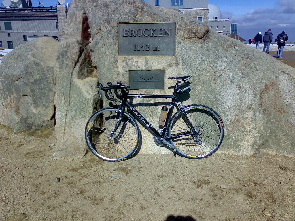
| | Brocken | 1,142m | |
| | Salwert | 11m | |
| Great Caucasus (Georgia) | |||
 | Abano Pass | 2,865m | |
| | Gergeti Trinity | 2,170m | |
| Andes | |||
 | Uturuncu | 5,768m | |
| | Chacaltaya | 5,300m | |
| | Salar de Uyuni | 3,650m | |
| | Yungas Death Road | 3,200m | |
| Himalayas | |||
 | Khardung La | 5,602m | |
| | Taglang La | 5,358m | |
| | Potokonkga La | 4,900m | |
| | Namshang La | 4,800m | |
| | Lamayuru Monastery | 3,714m | |
| Rocky Mountains | |||
 | Mount Evans | 4,307m | |
| Sierra del Escambray (Cuba) | |||
 | Topes de Collantes | 755m | |
| Hawaii | |||
| | Mauna Kea | 4,200m | |
| Ethiopian Highlands | |||
 | Tulluu Dimtuu | 4,377m | |
| Alborz-Range (Iran) | |||
 | Dizinpass | 3,257m | |
| | Emamzadeh Davod | 2,929m | |
| Marathon (European Alps) | |||
 | Ötztal Cycle Marathon | 5,209Hm | |
| | La Marmotte | 5,180Hm | |
 | Maratona Dolomites | 4,190Hm | |
| | Dreiländergiro | 3,546Hm | |
 | Alpenbrevet | 3,643Hm | |
| | Alpen-Challenge | 2,499Hm | |
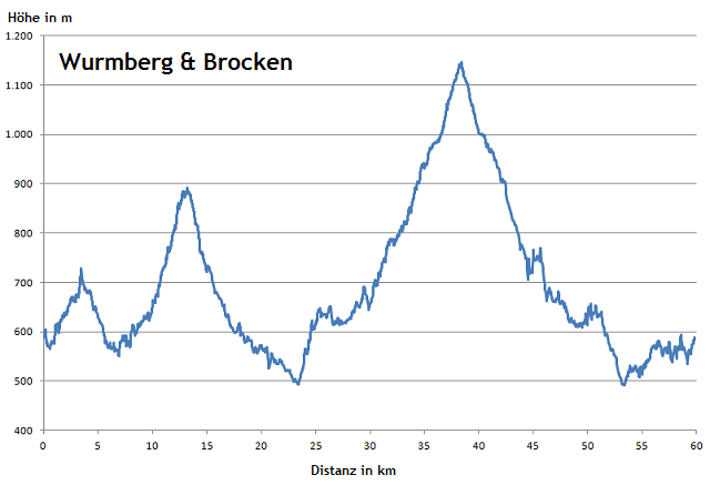
Wurmberg and Brocken in The Harz forest can easily be combinded in a pleasant road bike tour from Braunlage. Thus, you can reach two German federal state peaks - provided you find the right way to Wurmberg mountain. Until the end of the 1980's Germany and Europe were actually divided between these two mountains.
Start: Braunlage 580m
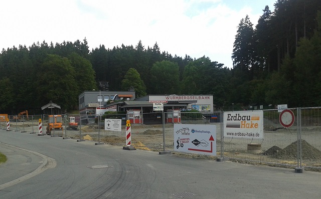
This is the valley station of Wurmberg cable way. But where is the supposed asphalted way to Wurmberg from the West? There is no sign indicating the right way and Google Maps reports several ways up to the mountain...
This is obviously the wrong way..
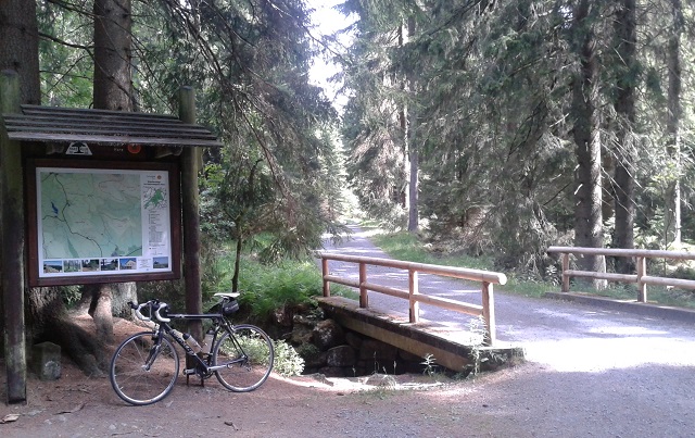
Next try from the East. This way leads to a parking area "Kaffeehorst". The road is asphalted and seems to be the correct one...
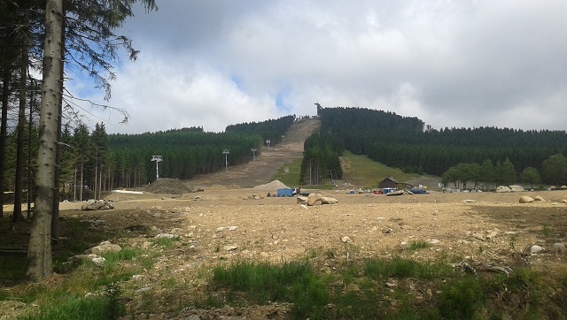
After a short climb this is the view to the new ski area at Wurmberg mountain. At the very top you can see the ski jump facility on the summit.
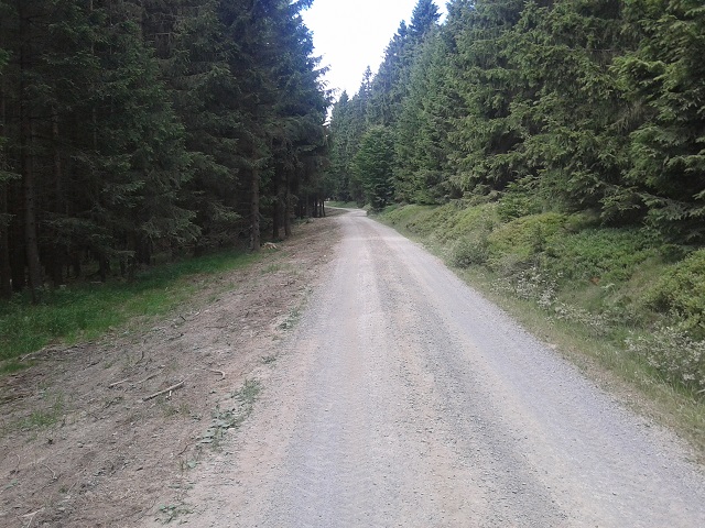
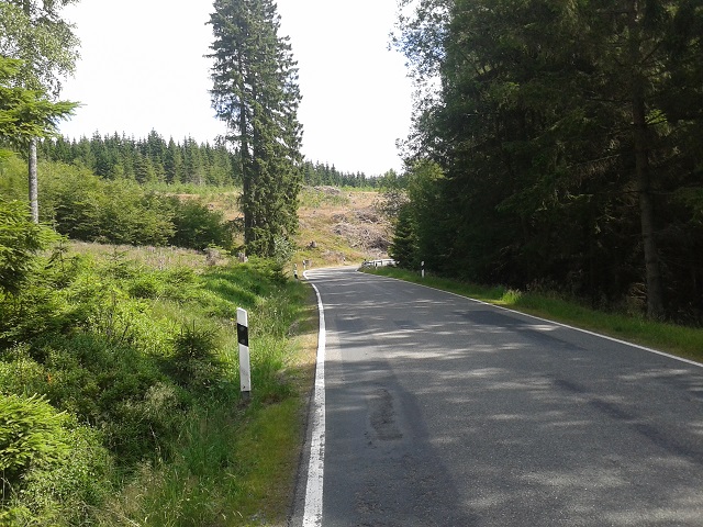
After the parking area it becomes clear that this is, again, the wrong way. Anyhow, the ride continues now on a graveled forest way. It even works an a road bike.
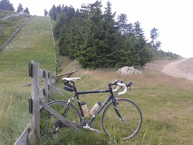
At an elevation of some 890 meters you have finally reached the bottom ground of the ski jump. The way to the right is actually not cyclable on a road bike but could have easily be done on mountainbike. (The right way would have been the only 300m long "Kegelbahnweg" in Braunlage with an asphalted road to the peak starting right at the end of that way.)
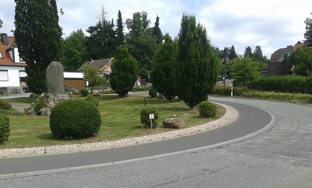
However, after the odyssey at Wurmberg a very convenient tour to Brocken mountain starts in Elend. At this traffic circle the 15 kilometers climb starts at an altitude of only 500m.
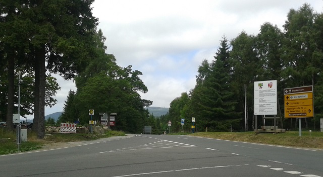
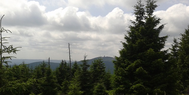
Junction to Schierke. In the very back the summit of Brocken mountain becomes visible.
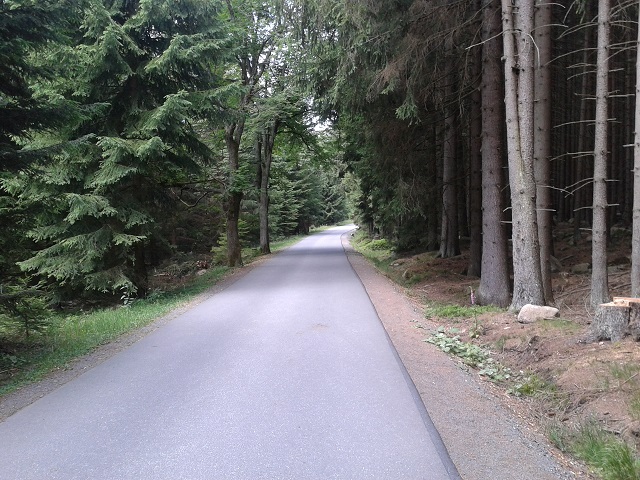
Stay to the right in Schierke village and you directly get to the Brocken road which is closed to motorized traffic. The road has newly been asphalted only few years ago and thus now provides great fun for road bikers. (In the past the road conditions were significantly worse / see below)
Wurmberg ski jump in the very back.
Great road with an average gradient of 6%.

On the final kilometer to the summit the road becomes crowed as several hiking paths converge right here.
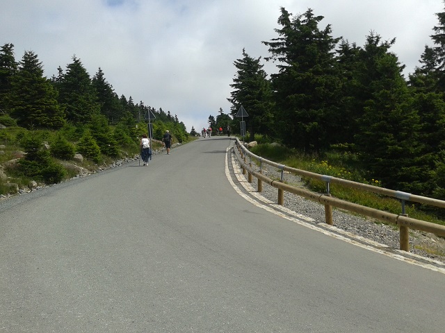
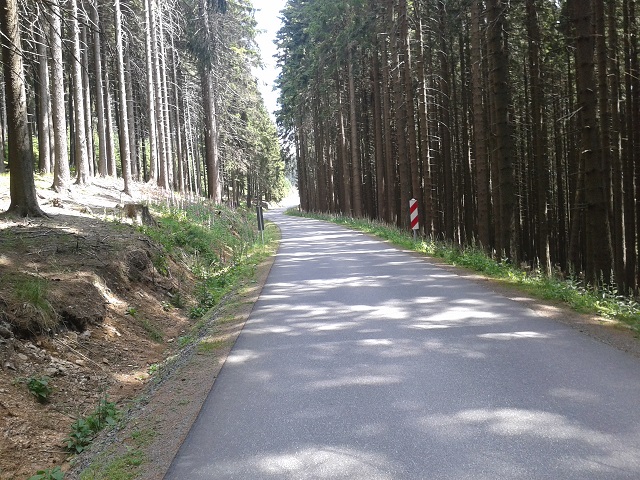
There is even a short part with a 10%+ slope.
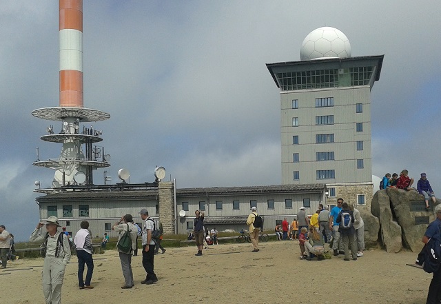
Telecommunication facilities on the summit.
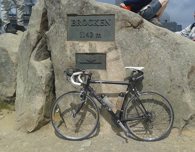
Summitted!
----------------------------
Far and wide the only mountain like in Northern Germany - so to speak the local mountain of Hamburg. However, the traffic-free pass road from Schierke shows catastrophic conditions after the winter impeding any pleasure mainly on the downhill ride. Moreover you have to share the last kilometer to the summit with hundreds of hikers as obviously all hiking paths to the summit are channelised here. However, a nice trip for season-kickoff!
Start: Elend 510m
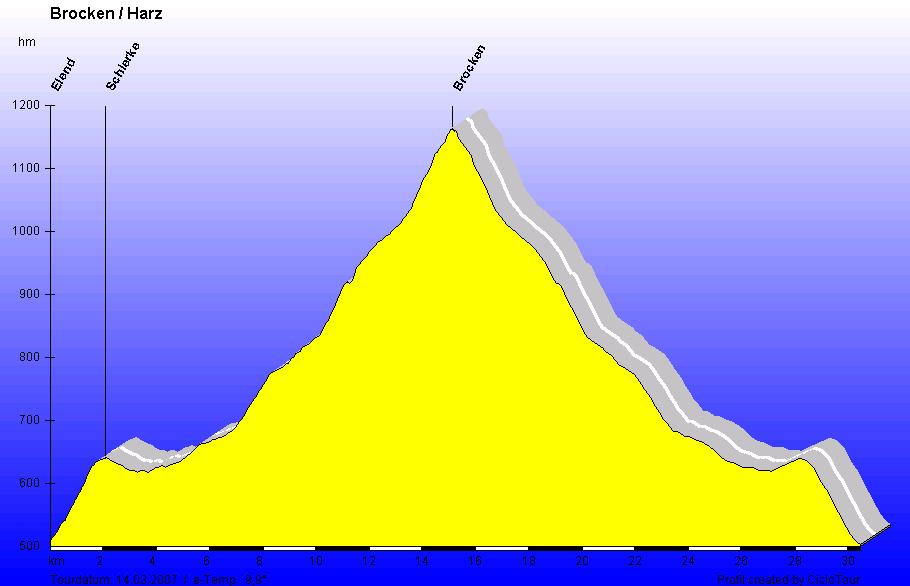
Elevation profile including return way
----------------------------
Alternative route: Mountainbike-course starting from Drei Annen Hohne with enjoyable downhill on the eastern ramp on former Eastern German military roads:
September 2004


