EN
DE


Welcome to the cutting-edge of uphill cycling
and world's most famous ascents of each of the continents


Welcome to the cutting-edge of uphill cycling
and world's most famous ascents of each of the continents
| Andalusia | |||
 | Mulhacen | 3,482m | |
| | Pico del Veleta | 3,394m | |
| | Pico del Veleta | 3,394m | |
| | O Sel Ling | 1,462m | |
 | Gibraltar Rock | 426m | |
| Canary Islands & Madeira | |||
| | Roque Muchachos | 2,426m | |
| | Tabonal Negro (Teide) | 2,362m | |
| | Pico de las Nieves | 1,945m | |
 | Pico do Arieiro | 1,802m | |
| | C. Pedro Gonzales | 490m | |
| Pyrenees | |||
 | Port d'Envalira | 2,408m | |
| | Ordino Arcalis | 2,232m | |
 | Col du Tourmalet | 2,115m | |
| | Col d'Aubisque | 1,709m | |
| | Col de Peyresourde | 1,569m | |
| | Col d'Aspin | 1,489m | |
| | Col du Soulor | 1,450m | |
| Mallorca | |||
| | Puig Major | 1,433m | |
| | Sa Calobra | 718m | |
| | Coll d'Honor | 550m | |
| | San Salvador | 510m | |
| | Coll de Sóller | 497m | |
| | Port de Valdemossa | 323m | |
| | Cap de Formentor | 225m | |
| Giant Mountains & Ore Mountains | |||
 | Sniezka | 1,602m | |
 | Modré Sedlo | 1,500m | |
| | Vrbatova Bouda | 1,400m | |
 | Klinovec | 1,244m | |
 | Fichtelberg | 1,215m | |
| | Spindlerpass | 1,200m | |
| Balkans | |||
 | Štulac Sedlo | 1,957m | |
| | Durmitor Sedlo | 1,908m | |
 | Kopaonik | 1,805m | |
 | Sveti Jure | 1,762m | |
 | Qafa Thores | 1,681m | |
 | Visočica Sedlo | 1,625m | |
 | Galičica Sattel | 1,564m | |
 | Prevalac | 1,560m | |
| | Qafa Bordolecit | 1,355m | |
| | Krstac | 958m | |
| Scandinavia | |||
 | Juvasshytta | 1,851m | |
| | Dalsnibba | 1,459m | |
 | Flatruet | 975m | |
| | Trollstigen | 866m | |
| | Ørnevegen | 623m | |
 | Muotkatakka | 565m | |
 | Halfdan | 504m | |
| | Kleifaheidi | 413m | |
 | Møllehøj | 171m | |
| Baltics | |||
 | Suur Munamägi | 318m | |
 | Gaizinkalns | 312m | |
 | Aukštojas | 294m | |
| Benelux | |||
 | Botrange | 694m | |
 | Kneiff | 560m | |
 | Vaalserberg | 323m | |
| Great Britain & Ireland | |||
 | Great Dun Fell | 848m | |
 | Mount Leinster | 793m | |
 | Lowther Hill | 724m | |
| | Cairnwell Pass | 670m | |
 | Bwlch y Groes | 550m | |
| | Bwlch Pen-y-Feidiog | 530m | |
| | Sally Gap | 501m | |
 | Spelga Dam | 404m | |
| European micro states | |||
| | Port d'Envalira | 2,408m | |
 | Pfälzerhütte | 2.108m | |
 | Monte Titano | 652m | |
 | Dingli Cliffs | 245m | |
 | Chemin Révoires | 164m | |
 | Vatican Hill | 77m | |
| Carpathians | |||
 | Transalpina | 2,145m | |
| | Transfagarasan | 2,042m | |
 | Sliezsky Dom | 1,670m | |
| Cornesti Hills (Moldova) | |||
 | Balanesti Hill | 429m | |
| Voras Mountains (Greece) | |||
 | Voras Ski Center | 2.074m | |
| Yildiz Mountains (Turkey) | |||
 | Mahya Dagi | 1,031m | |
| Serra da Estrela (Portugal) | |||
 | Pico Torre | 1,993m | |
| Trodoos Mountains (Cyprus) | |||
 | Olympos | 1,950m | |
| Matra Mountains (Hungary) | |||
 | Kekestetö | 1,014m | |
| Rila Mountains (Bulgaria) | |||
 | Kalin reservoir | 2,550m | |
| Germany | |||
| | Osterfelderkopf | 2,032m | |
| | Nebelhorn | 1,932m | |
| | Alpe Schlappold | 1,740m | |
| | Eagle's Nest | 1,716m | |
| | Roßfeld-Höhenring | 1,540m | |
| | Riedbergpass | 1,420m | |
| | Feldberg | 1,493m | |
| | Fichtelberg | 1,215m | |
| | Brocken | 1,142m | |
| | Salwert | 11m | |
| Great Caucasus (Georgia) | |||
 | Abano Pass | 2,865m | |
| | Gergeti Trinity | 2,170m | |
| Andes | |||
 | Uturuncu | 5,768m | |
| | Chacaltaya | 5,300m | |
| | Salar de Uyuni | 3,650m | |
| | Yungas Death Road | 3,200m | |
| Himalayas | |||
 | Khardung La | 5,602m | |
| | Taglang La | 5,358m | |
| | Potokonkga La | 4,900m | |
| | Namshang La | 4,800m | |
| | Lamayuru Monastery | 3,714m | |
| Rocky Mountains | |||
 | Mount Evans | 4,307m | |
| Sierra del Escambray (Cuba) | |||
 | Topes de Collantes | 755m | |
| Hawaii | |||
| | Mauna Kea | 4,200m | |
| Ethiopian Highlands | |||
 | Tulluu Dimtuu | 4,377m | |
| Alborz-Range (Iran) | |||
 | Dizinpass | 3,257m | |
| | Emamzadeh Davod | 2,929m | |
| Marathon (European Alps) | |||
 | Ötztal Cycle Marathon | 5,209Hm | |
| | La Marmotte | 5,180Hm | |
 | Maratona Dolomites | 4,190Hm | |
| | Dreiländergiro | 3,546Hm | |
 | Alpenbrevet | 3,643Hm | |
| | Alpen-Challenge | 2,499Hm | |
In the European part of Turkey, on the border with Bulgaria, there is a small mountain range with a paved road leading to its highest peak. The route there is rather unpleasant for cyclists. In addition to stray dogs, there is a lot of heavy traffic due to the various quarries in the area. Motorists are unaware of cyclists and speed past at close range, often overtaking oncoming traffic. There are police roadblocks along the way and the summit is no longer accessible as it is now a restricted military area. I was glad to leave. (But the people were all very friendly.)
Start: Poyrali 253m
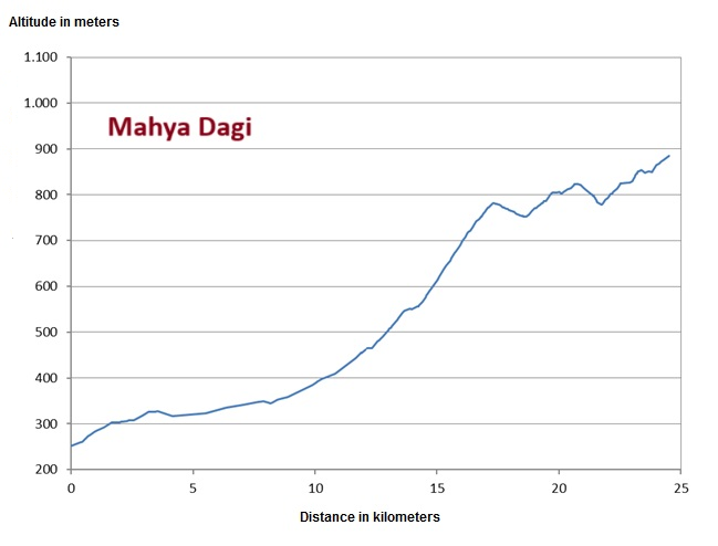
The steepest section is behind the village of Yenice, at around kilometre 15, up to the pass just below 800 m. There, a moderate one-way-street branches off towards the summit.
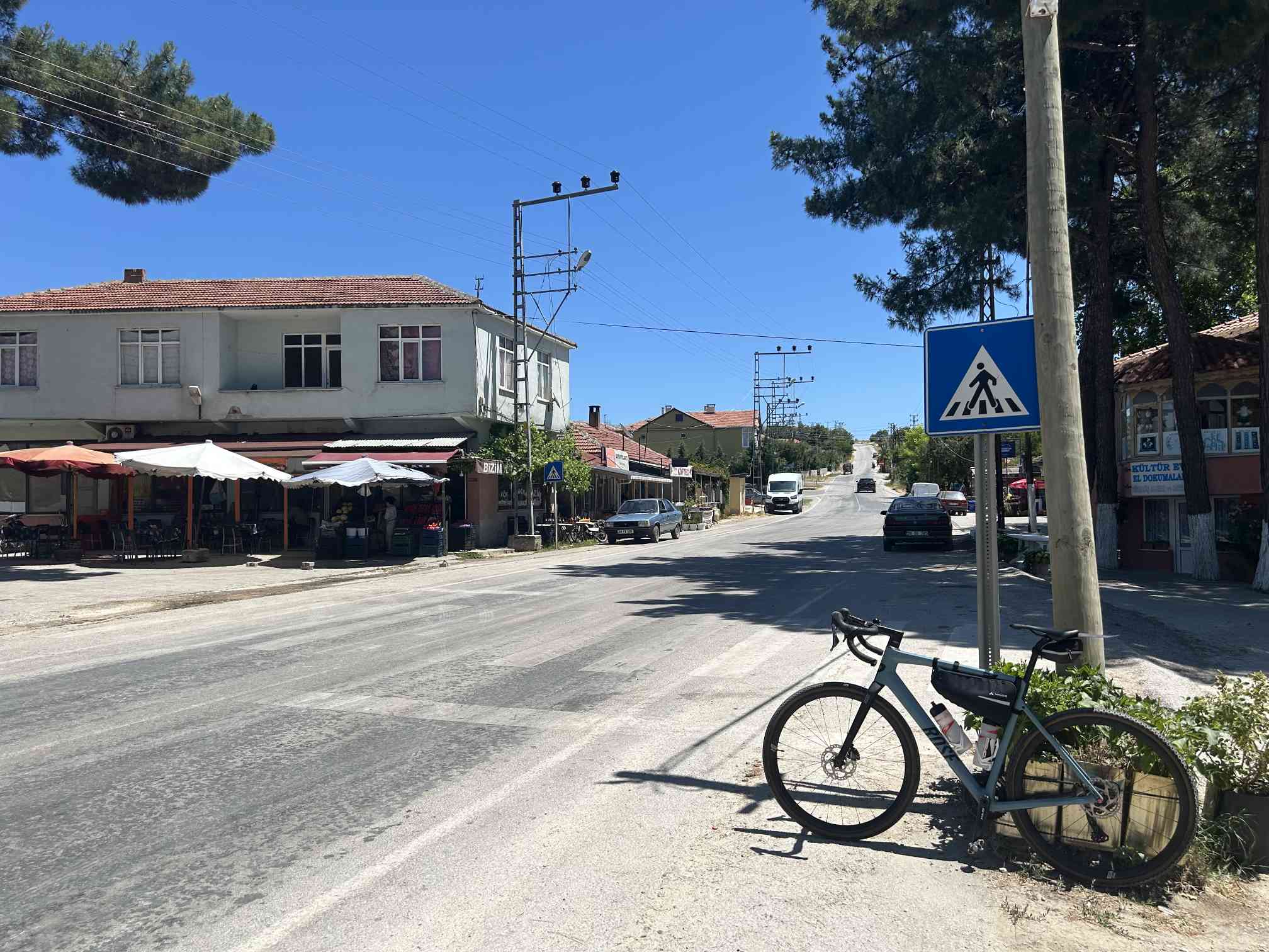
We set off in temperatures of over 30 degrees in this small village.
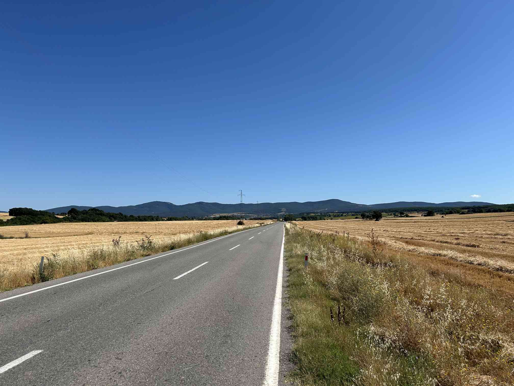
We follow the D565 road, which leads to the Black Sea. The first 13 kilometres run straight ahead with a view of the mountain range that is our destination for today. A small radar station can be seen in the distance on the summit on the far left.
Then we reach the village of Yenice.
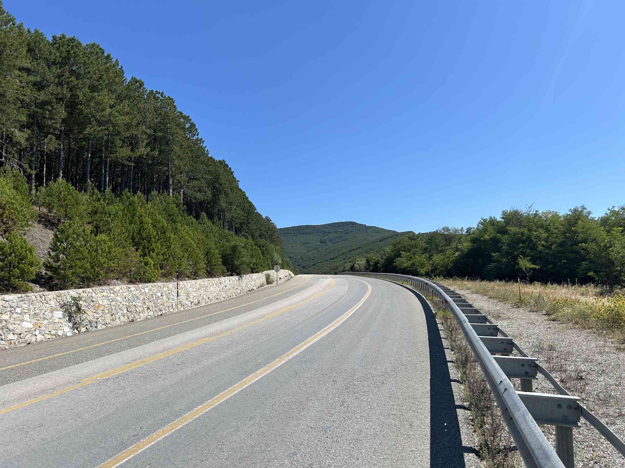
Behind the village, the gradient increases significantly and the road widens considerably so that heavy goods vehicles can crawl up the passroad.
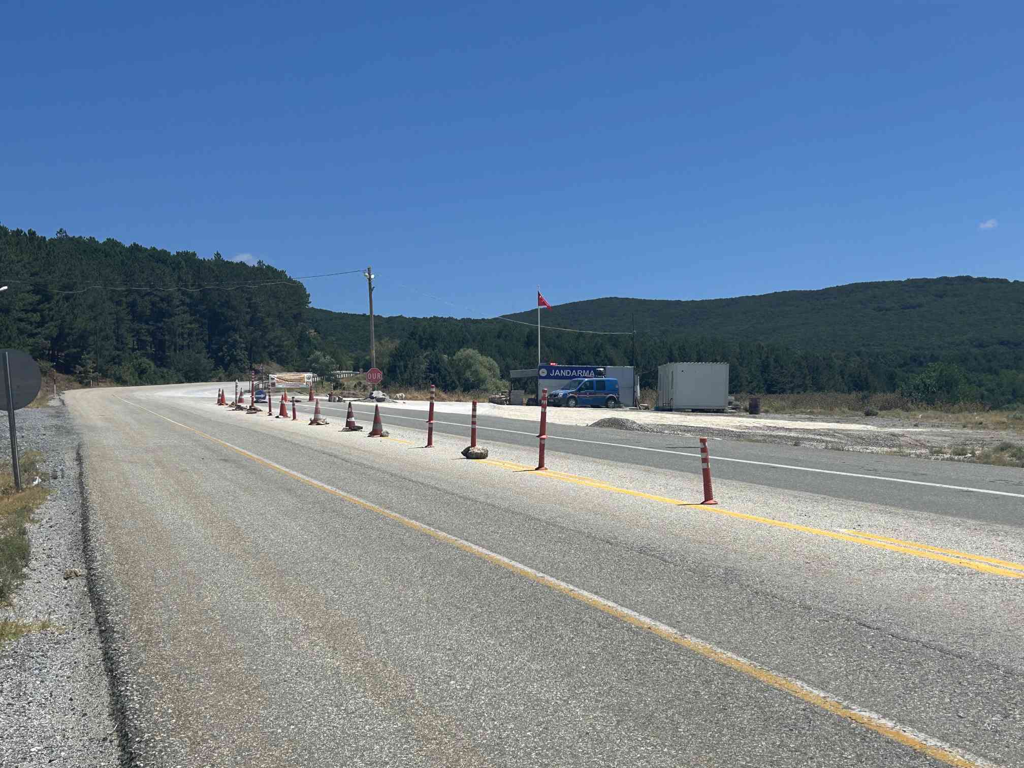
Suddenly, there is a roadblock (as experienced elsewhere in Turkey). Here, you have to leave the road and drive through loose gravel past a police container. They let me through.
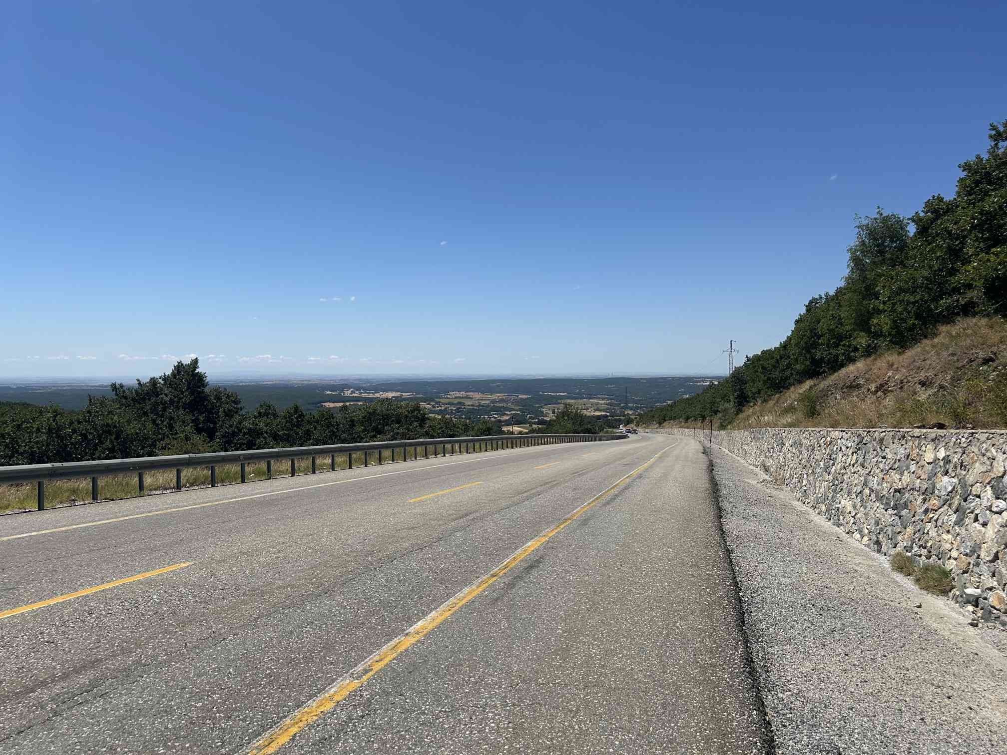
Looking back
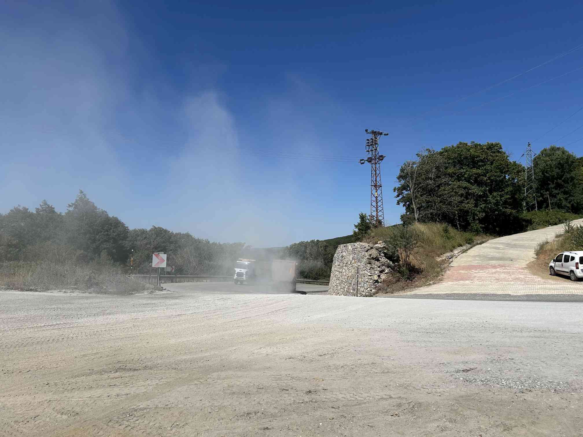
At the top of the pass, heavy goods vehicles can be seen on the left, enveloping everything in clouds of dust. The road leads straight ahead to the summit of Mahya Dagi.
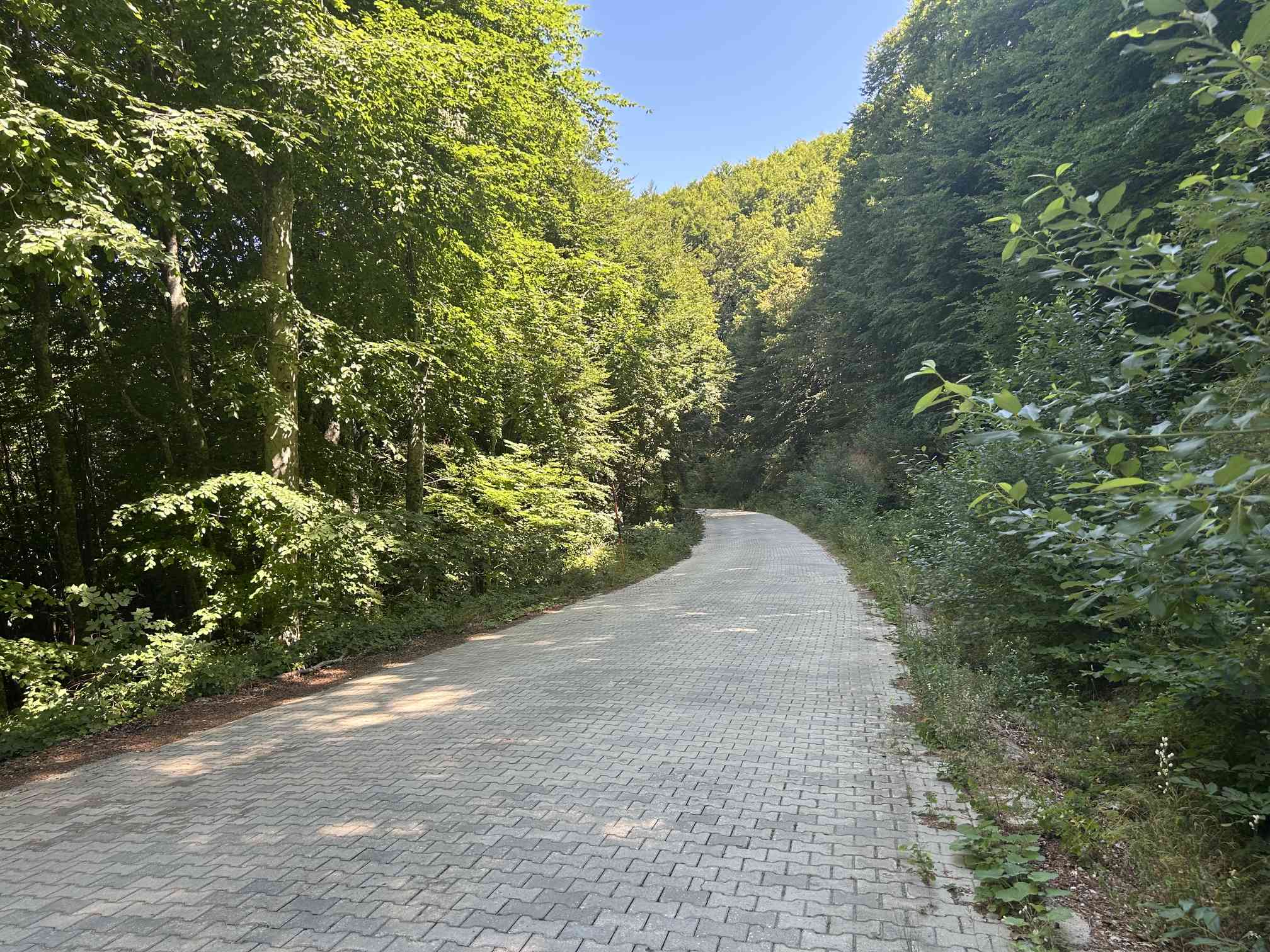
Here, it suddenly becomes quieter and much more pleasant to cycle.
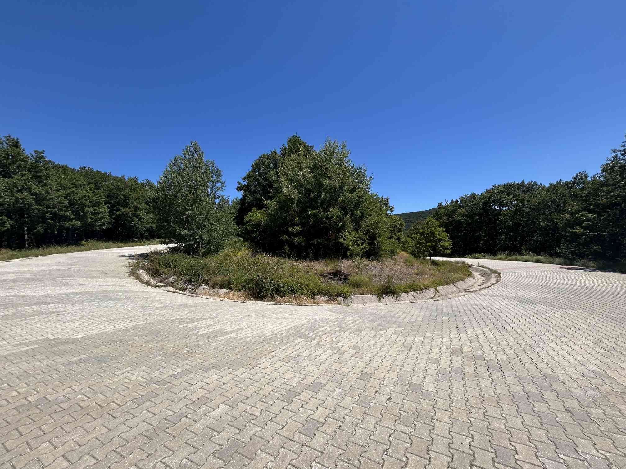
On the way up, there is even a nice wide hairpin bend. Always a highlight for any biker.
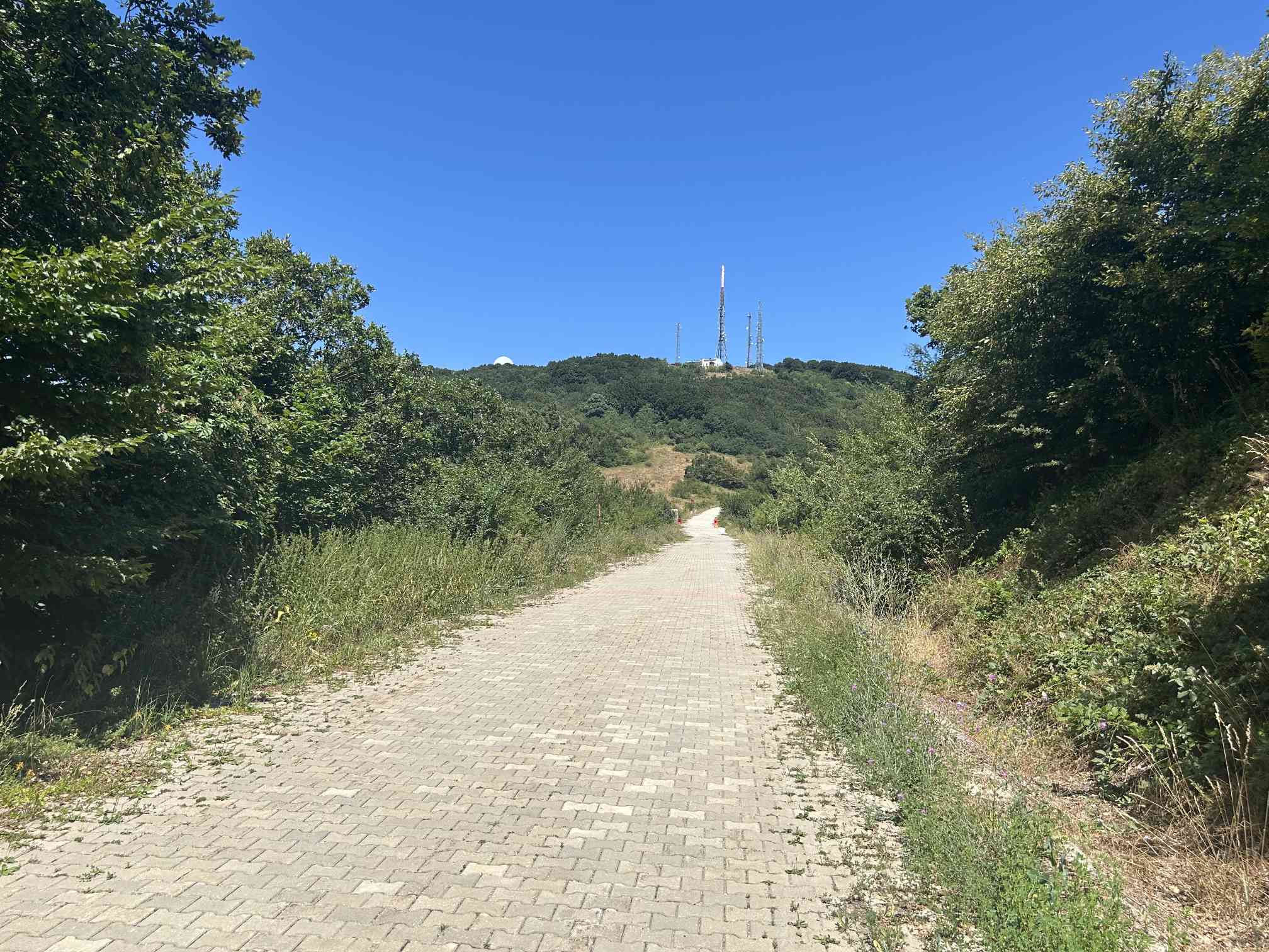
Nevertheless, there is a certain tension in the air. At the top, there is said to be a strict ban on photography and the Turkish military is said to be rather strict. On the way, the first surveillance cameras appear at the side of the road. At the back left, the radar dome on the summit is visible.
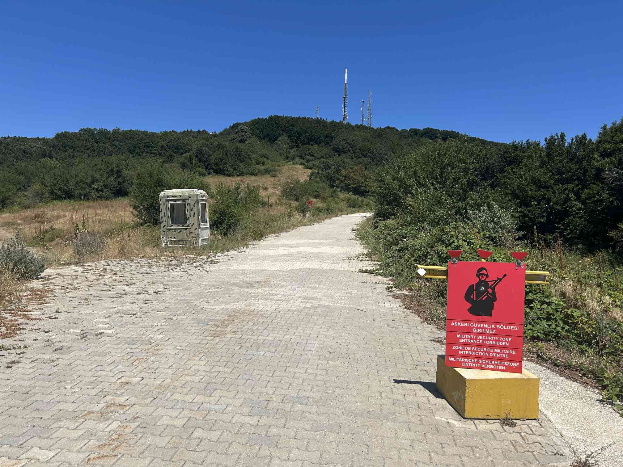
At an altitude of 885 metres, just below the summit, there is a surprise: the military is closing the road. There was no mention of this in recent travel reports, so it must be new. What now? The guardhouse does not appear to be manned. But the message on the sign is clear – in several languages.
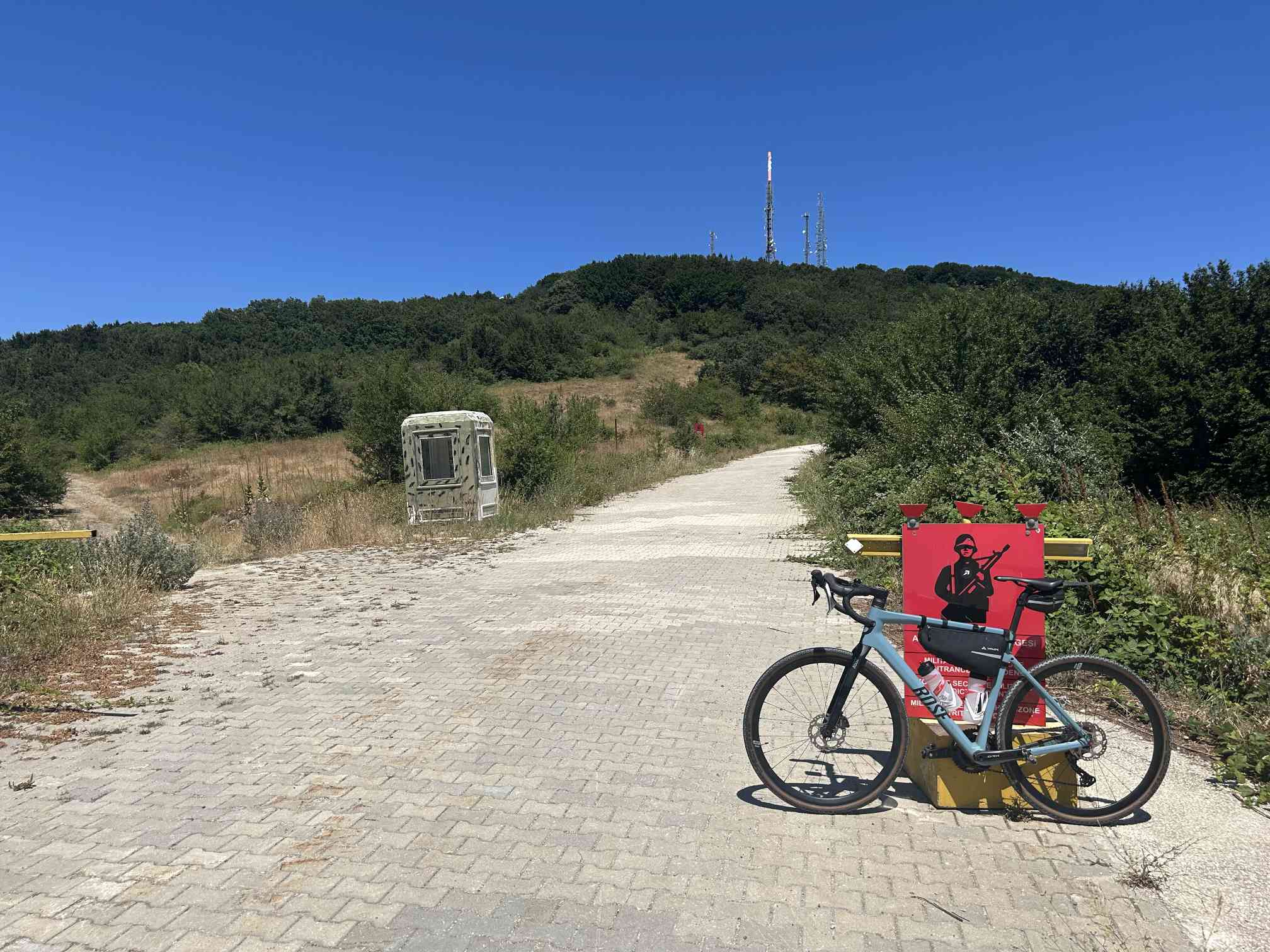
No one around, but cameras. A quick ‘summit photo’ and down again even faster.
No, it wasn't a nice country point – but I got it :-)


